
Hurricane Helene makes landfall as a devastating category 4 hurricane near Perry and Salem, Florida at approximately 11:15 PM EDT with maximum sustained winds of 140 mph and a central pressure of 938 mb. Hurricanes are ranked in a category scale from 1-5 based on the speed of the sustained winds within the inner eye wall of the storm.
- Category 1: 74–95 mph, minimal damage
- Category 2: 96–110 mph, moderate damage
- Category 3: 111–129 mph, extensive damage
- Category 4: 130–156 mph, devastating damage
- Category 5: 157 mph or higher, catastrophic damage
The National Hurricane Center made remarks on their latest readings at 11:00 PM EDT that the estimation of 140 mph sustained eyewall winds may be conservative. Later data will be needed to obtain the exact wind speed and central pressure.
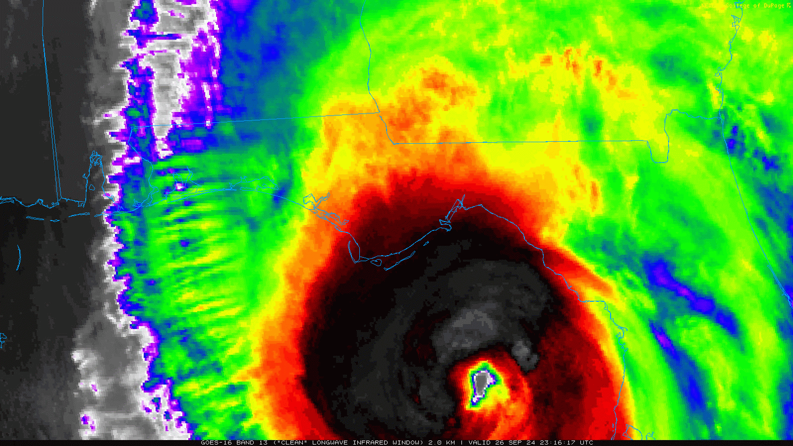
Longwave IR of Hurricane Helene via goes 16
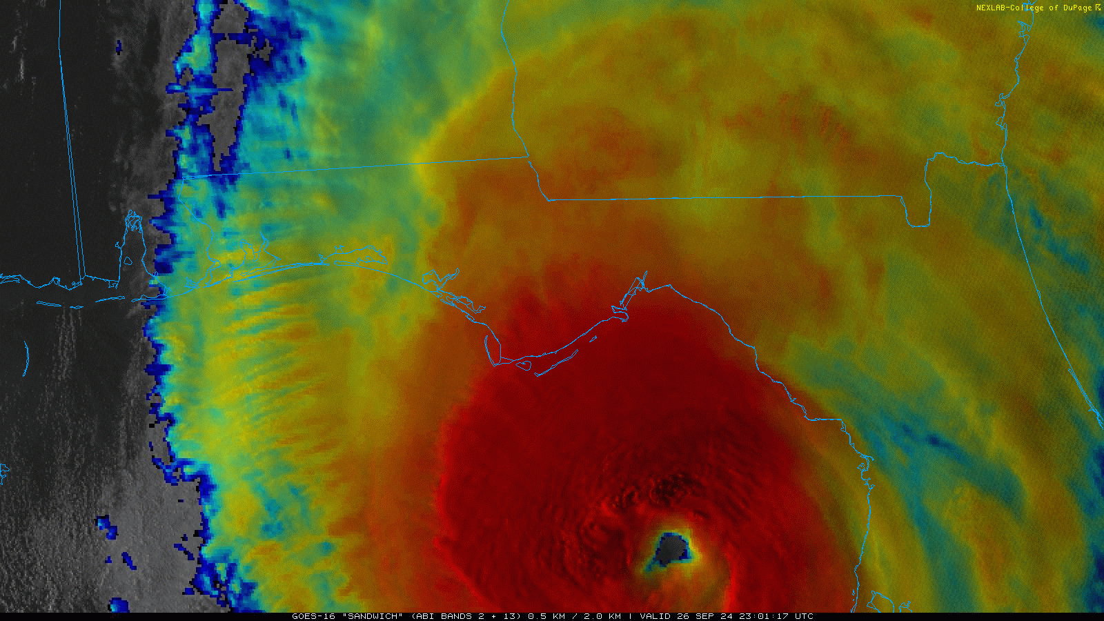
Sandwich IR of Hurricane Helene via goes 16
Power outages are estimated at nearly 1,000,000 people as of 11:30 PM ET. Storm surges are expected to peak at 20+ feet along the Big Bend Area of Florida with several tornadoes moving inland through the southeast along with upwards of 20+ inches of rain moving inland through the Southeast resulting in devastating potential flash flooding.
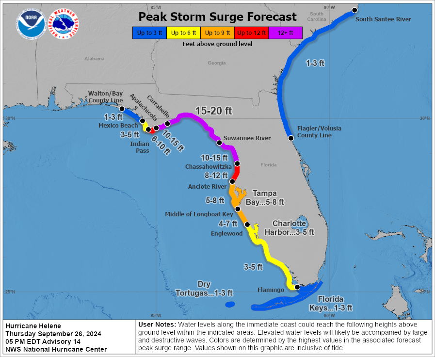
Estimated peak storm surge via National Hurricane Center
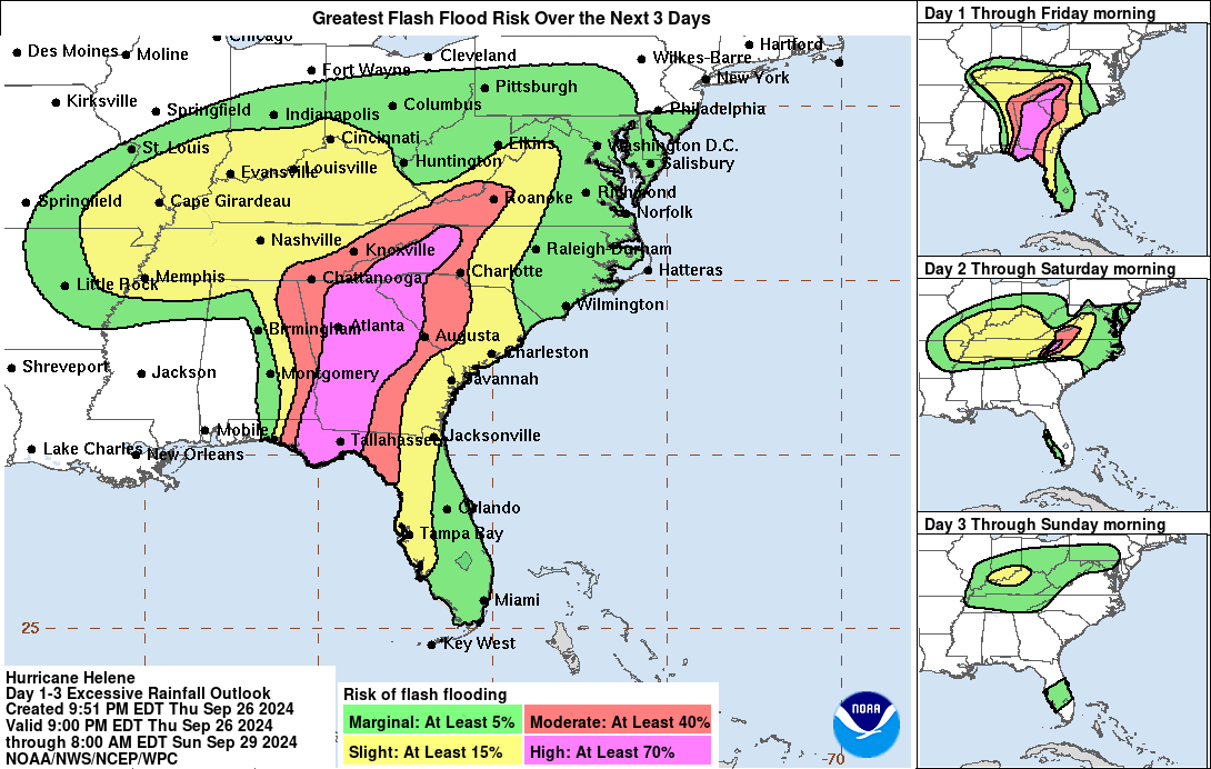
Flash flood risk via National Hurricane Center
Meteorologist,
Justin Storm
Intense power flashes happening in Perry FL pic.twitter.com/3DIuEKxHQd
— Caleb Beacham (@CB_StormChasing) September 27, 2024
🚨🇺🇲HURRICANE HELENE SLAMS ST. PETERSBURG
VENETIAN ISLES HOME BATTERED
– Storm surge floods neighborhood
– Roof torn off, severe damage reported
– St. Petersburg feels Category 4 furySeptember 26, 2024 #hurricanehelene #StPetersburg#Helene pic.twitter.com/h2EasKZXsk
— Weather monitor (@Weathermonitors) September 27, 2024
4+ houses floating away around us #Helene pic.twitter.com/AjDUu6xo51
— Aaron Rigsby (@AaronRigsbyOSC) September 27, 2024
Dangerous storm surge occurring in Steinhatchee. Mobile homes moved by 8-10' of surge.#Helene #FLwx https://t.co/B9vEHpdH5N
— NWS Tallahassee (@NWSTallahassee) September 27, 2024


