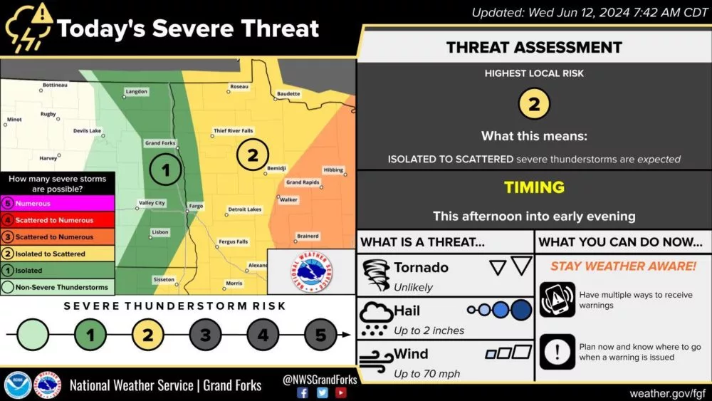
Although today severe weather potential favors areas of Minnesota this afternoon and evening. There will still be a chance for a couple of isolated strong to severe storms to develop in the Red River Valley. Storms will then push eastward and become stronger and more scattered.
The main window for isolated storms to develop within Eastern North Dakota and the Red River Valley will be mainly after 3:00 pm until about 5:00 pm. After that, most of the threat area will push into Minnesota. Areas of western and central/northern Minnesota’s timing will be more in the 4:00 pm to 8:00 pm window.
The main threat with these storms will be hail up to two inches in diameter, and wind gusts up to 70 mph or stronger with some of the strongest storms. An isolated tornado, although unlikely can’t be ruled out.
See the above image for the risk area.
Cover photo SPC OUTLOOK issued Wednesday 11:30 am 6/12/24.
You can get the latest risk area here!
Meteorologist,
Justin Storm