You often hear a meteorologist say, “our weather models are showing us (this/that)” Now, weather forecasting has come a LONG way over the last 50 years, however, there is still a long way to go. When it comes to short term models (24 to 48 hours) our accuracy is pretty good. When it comes to our long term forecasting (5 to 7+ days) the accuracy goes down hill fast. That’s why we use the LRC for long term forecasting with a 70% accuracy rate.
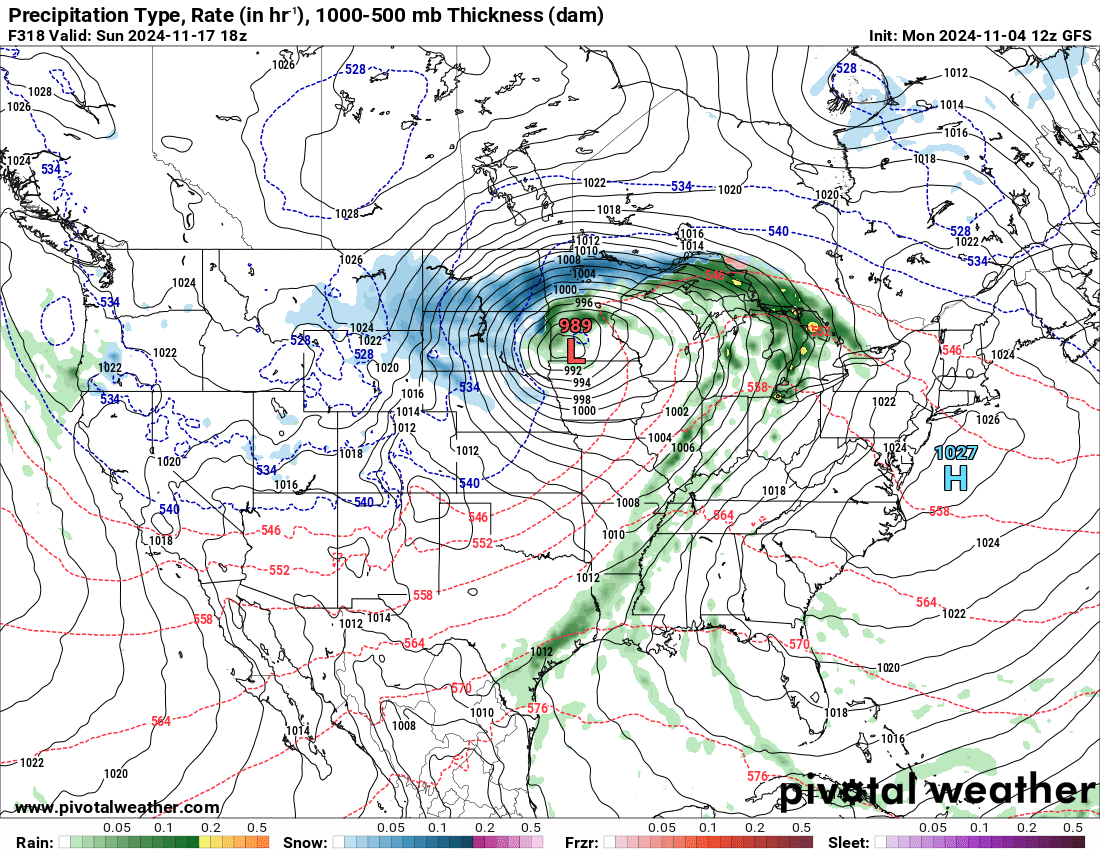
Let’s give an example of how the models flip/flop when it comes to bigger storms. Here is a perfect example of a storm coming in around 10 days (Nov. 17th.) and how the models can change things drastically in just a few days. Here is a look at the 17th with Monday’s long term model:

This is a snapshot of Sunday (17th) afternoon showing a major snow event occurring here in the N. Plains. Snow/wind…..looks like a mess
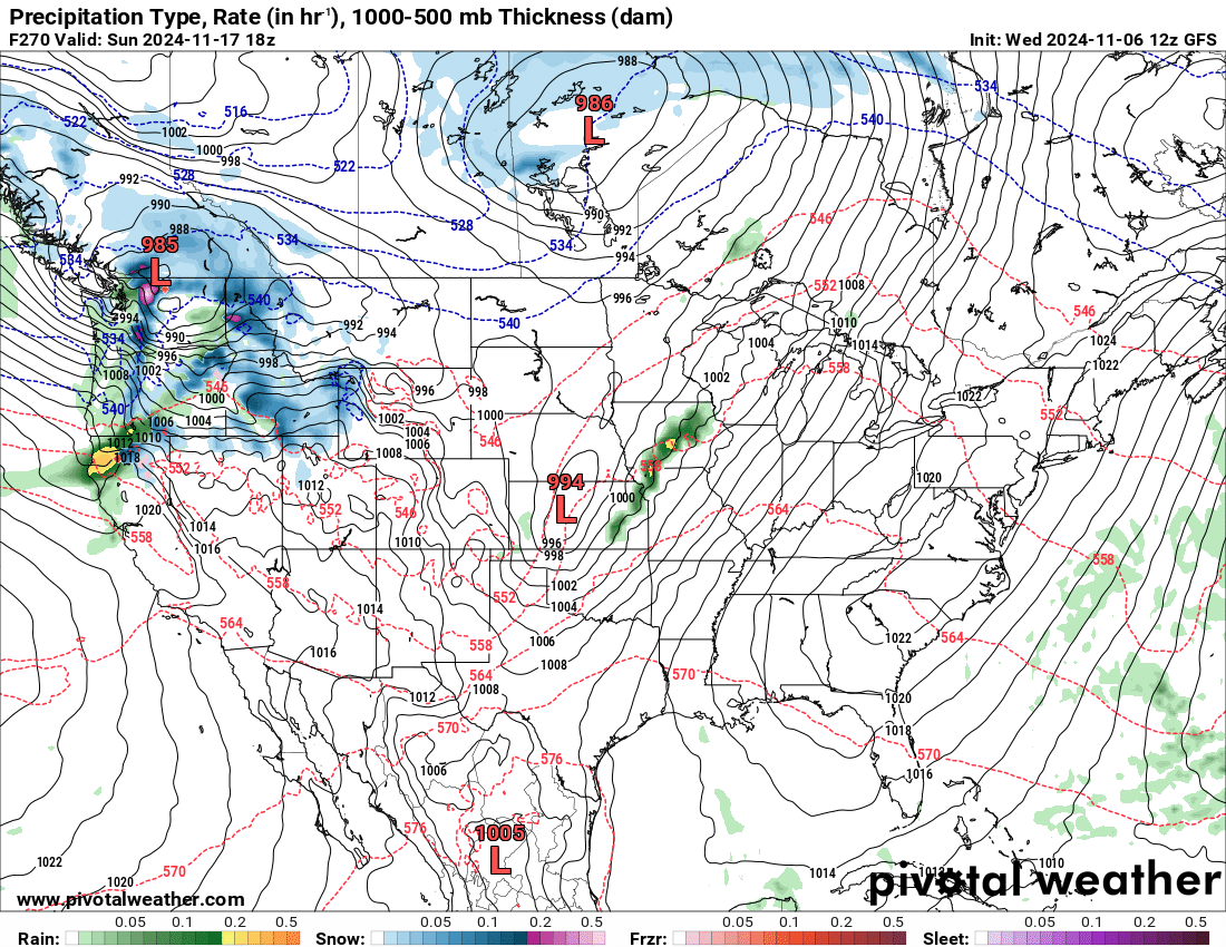
Now…..here is the same day, from the same model which came out this morning:

NO STORM now for the 17th as it has the area of low pressure in KS in a much weaker version. How can there be such a BIG difference in just a 2 day span? Well, that’s a discussion for another day, but just another reason NOT to put all your trust in just ONE model let alone anything past 2-3 days. When these models show this much of a change, one thing we do know is that there are likely BIG changes down the road but the models just aren’t handling it correctly. In this case, there is likely much colder air coming into our area after mid month but will there be a storm to precede the cold air?? That is where the models are having difficulty……STAY TUNED…..
Chief Meteorologist,
Dean Wysocki (weather@flagfamily.com)


