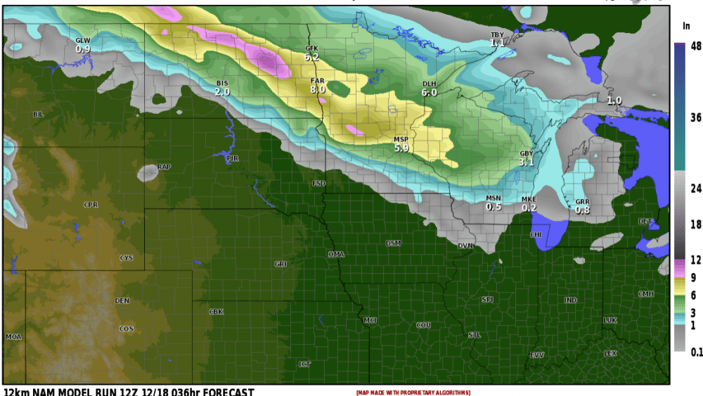
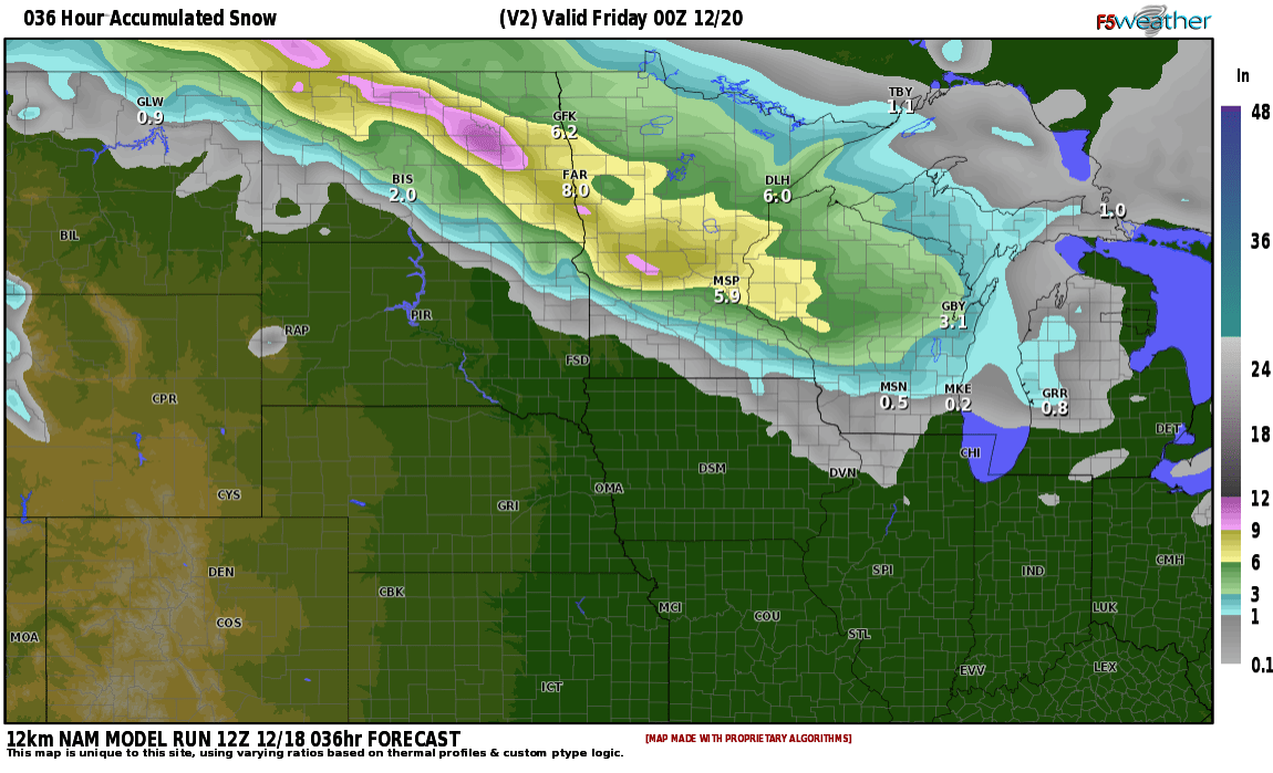
WINTER STORM WARNING IN EFFECT TONIGHT THROUGH THURSDAY: A strong clipper system will likely bring the season’s biggest snowfall. So far the biggest storm across much of the area was 2-4″ and most models are predicting 4-8″ across the area. Here are a few of the models we use and their predictions:
![]()
Snow Potential Courtesy f5 weather
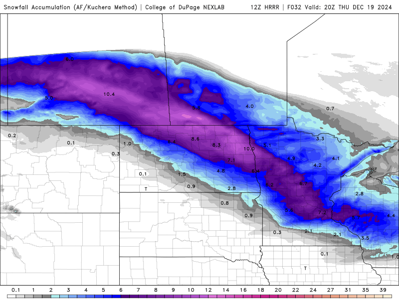
As you can see, models are in pretty good agreement with a few being a bit on the high side. Again, expect conditions to deteriorate during the overnight hours with snow coming to an end early afternoon, we will have some blowing snow for the afternoon/ evening hours producing reduced visibilities. I’m thinking around 6″ in the F/M area but there will be “banding” of the snow that could produce totals closer to 8″ in some areas.
