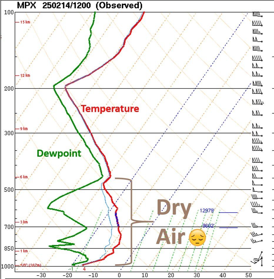
Often times like today, you see snow on radar but nothing is reaching the ground….why is that? Everyday across the USA weather balloons are launched twice a day to record the weather above us. We HAVE to know what the weather is doing above us, but, the good old fashion weather balloon collects vital information. We call the information we get from these weather balloons, upper air soundings:
Upper air sounding
Courtesy: NOAA
The graph you see here is information the weather balloon gathers as it ascends into the upper levels of the atmosphere. It gathers temp (red line) dew point (green line) and wind direction and wind speed (far right side) 850mb = approx. 5,000 feet 500mb which is about 1/2 way through the atmosphere (18,000 ft)
When the red line and green line are close together, the atmosphere is nearly saturated. When the red and green line are far apart, that indicates dry air. So, when precip aloft is falling into dry air (here its between 5,000 ft and about 19,000 ft) it tends to evaporate before reaching the ground. So, although there is precip on radar, it doesn’t ALWAYS mean it’s reaching the ground.