We’ve seen just over a foot of snow this winter season but more is on the way. Our latest models are hinting at “banding” of the snow which means some areas could pick up a bit more over a short distance. Let’s take a look at what I’m talking about:
Courtesy COD weather
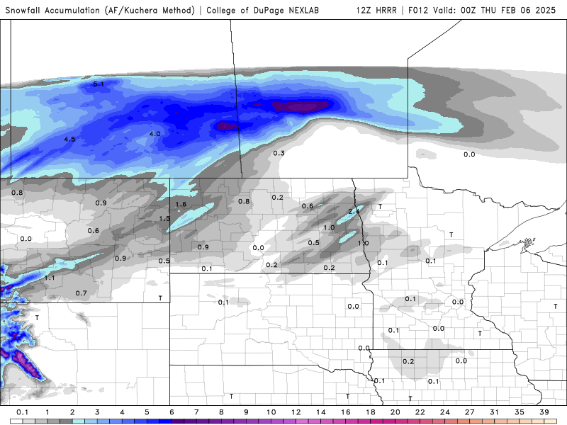
Notice the darker “bands” of the snow around Grand Forks and just NW of Fargo. These are narrow bands of heavier snow developing over the area around 4-6pm this evening. While areas that get caught under the heavier snow bands, areas just outside of those bands won’t see nearly as much. Here’s what snowfall potential looks like:
Courtesy COD weather
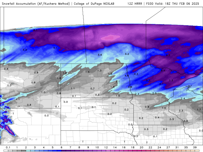
A general 2-4″ looks likely across most of the area with lesser amounts in the far southern valley. The problem is going to come overnight into tomorrow morning when strong WNW winds develop around 20-40mph. This will cause quite a bit of blowing and drifting of the snow, reduced visibilities and slick travel. Plan on leaving extra time for your morning commute on Thursday.
More snow comes into the area on Saturday with another 2-4″ likely. This is stormy part of the LRC cycle which will last about another 2 weeks. We will have Gary Lezak on WAG today at 1pm on WDAY to discuss the LRC and what the rest of winter looks like.
Chief Meteorologist,
Dean Wysocki