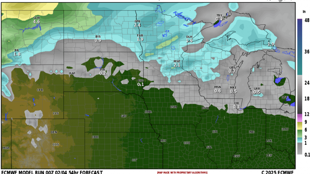
We’ve only had around 15″ of snow so far this season so to say it’s been quiet is an understatement. However, we are now going into the “stormy” part of the LRC cycle through the 21st of the month which will bring us quite a few chances for snow. Our next system will be coming our way Wednesday evening into Wed. night. Latest model guidance is predicting light accumulations:
A general 1-3″ of snow is possible. BUT, and there is always a BUT…..winds behind this system will increase significantly on Thursday morning 25-35 and gusty providing blowing/drifting snow and a messy Thursday AM commute.
Our next system comes into the area on Friday night into Saturday and this one will provide slightly higher snowfall totals with the higher totals along and south of the 94 corridor with 3-5″ of additional snow expected with some higher amounts likely into lakes country. Stay tuned…..
Chief Meteorologist,
Dean Wysocki