Welcome to LRC 101!! I’m going to go over, in a brief way, of HOW the LRC (Lezak Recurring Cycle) is used and HOW we use it to forecast long term. There are only TEN meteorologists in the country that are trained on how to use this and Justin and myself are 2 of them. If you are new to the LRC it is a relatively NEW way to forecast long term weather using a “cycling” method. Every year around Oct. 6th a new pattern sets up. We use our upper air charts (500mb or around 18,000 ft up) this is about 1/2 way up through the “atmosphere” and is what we focus on. Once the cycle length is “set” we can accurately forecast out months in advance with better accuracy than a 10 day forecast you may find on your app.
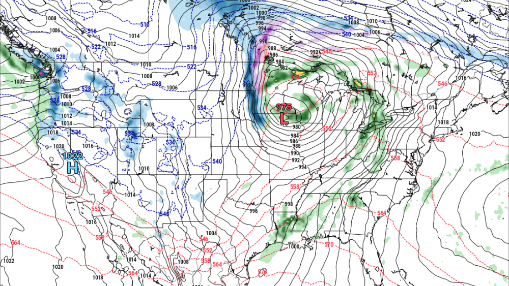
I’ve decided to use our CHRISTMAS storm as an example here. Around Christmas, we had a major storm impact our area with a major ICE storm to our west but mainly rain here in the Valley. This was, so far, the biggest and most impactful storm of the season. The one map (black and white) shows our upper air pattern on Christmas. A large upper low was parked just south of our area which was responsible for the ice/rain in our area. At that point in time, we had the cycle length set and could accurately forecast out months in advance (https://www.wdayradionow.com/weather/71907-lrc-calendar-weather-outlook-…)
Let’s fast forward to NEXT week and take a look at that storm (colored map) By knowing the cycle length we could predict this was arriving this week. Notice the similarities. It’s the same but a bit different. Notice the upper low (red L) parked over the same area approx. 45-46 days apart (this years cycle length) Ridges to our east on both maps (black squiggly line) and ridges to our west.
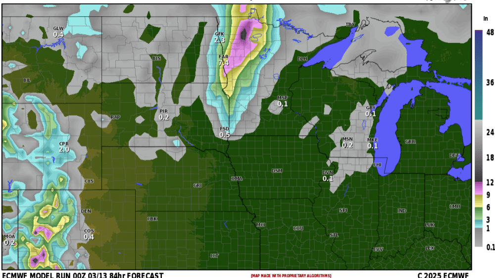
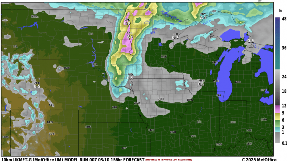
NOW, how will next weeks storm compare to the Christmas storm? It is expected to be another good precip maker (1/2″ to 3/4″ ) however, this time around I’m not seeing as much ICING conditions. Current thinking is that from the Valley and eastward this will start as rain then change over to snow. How much snow??? At this standpoint, I’m not looking for a LOT of snow, however, it does highly depend on the exact track of the storm and its intensity. Currently, I don’t believe the models are handling the strength of this storm correctly. The current path of the storm is typically a good snow maker for the F/M area but is the cold air lacking? Is the LRC perfect? NO…..but it’s definitely a very helpful tool to forecast long term. Using the LRC method this storm is expected back in the area toward the end of March. Stay tuned……
Chief Meteorologist,
Dean Wysocki


