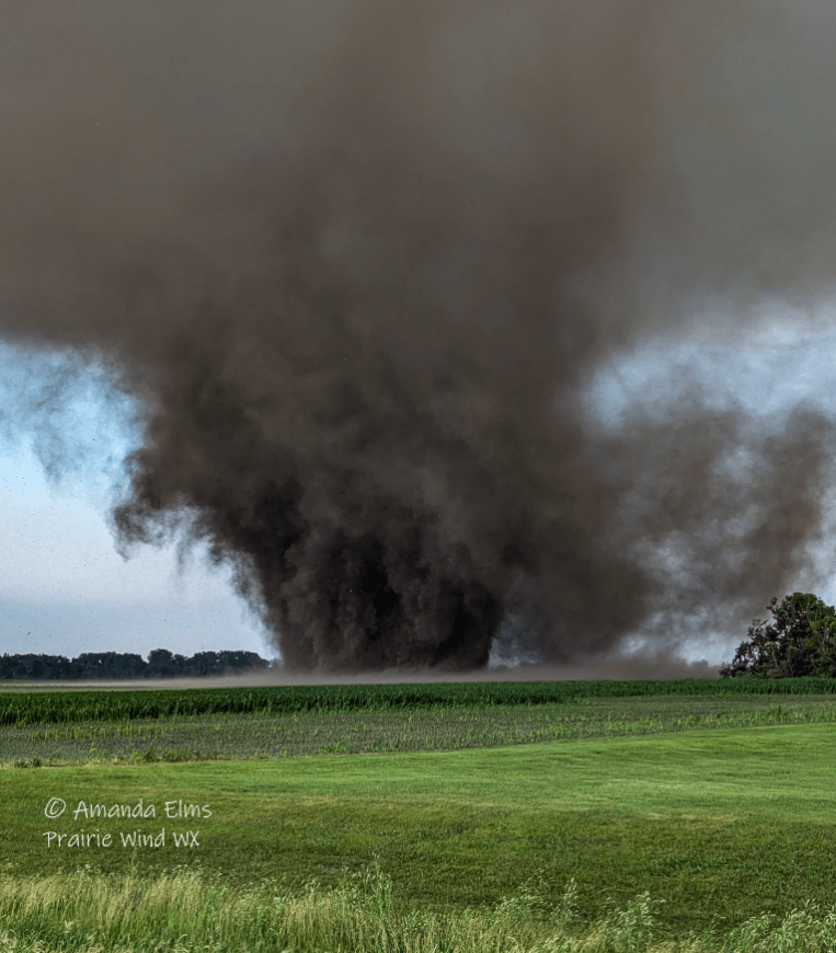
Several severe thunderstorms developed along a boundary moving south perpendicular to the Red River of North Dakota extending into Minnesota. Storms produced several reports of damaging wind gusts and large hail including a couple of tornadoes in North Dakota’s Richland County near Colfax, Barney, Mooreton, and Dwight. The most significant of said tornadoes, was a (preliminary) 26 yard wide EF1 tornado with an estimated peak wind speed of 107 mph that danced through 13.03 miles of relatively open farm fields, dodging several towns and farms. As this Tornado evolved and gained strength, it picked up more soils and plant matter from the ground and fields giving it a very “dirty” black coloring to its cone. The tornado was on the ground from approximately 7:15 – 7:58 pm CDT, before lifting just a mile north of Mooreton ND, and a few miles west of Dwight ND (approx. 40 miles south of Fargo). Thankfully there are no reports of injury or structure damage, mainly just tree damage, ground scarring, and some wind-whipped/missing crops in its wake.
Here are some amazing close-range photos Nick and Amanda Elms took. You can find them on Twitter/x (@PrairieWindWX) as well as Facebook.

Richland County ND Tornado from Saturday Evening 7/13/24 Via X Photo Credit Nick & Amanda Elms @PrairieWindWX
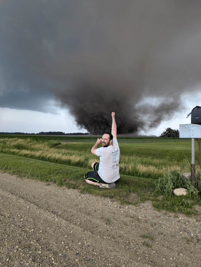
Richland County ND Tornado from Saturday Evening 7/13/24 Via X Photo Credit Nick & Amanda Elms @PrairieWindWX
https://x.com/i/status/1812323529335140801
Meteorologist,
Justin Storm