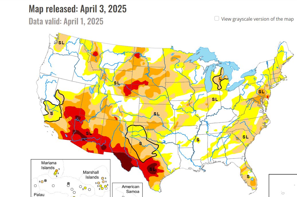
It was a pretty tame winter for most of us this year with snowfall well below normal. Drought conditions continue to plague the western part of ND:
Courtesy UNL
As we take a look into spring/summer, there is some good news on the horizon in regards to rainfall, however, parts of western ND will still remain in drought conditions through summer.
Here is a breakdown month by month. Let’s start with May:
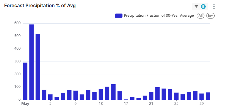
The western part of the state as a whole will only see about 75% of normal rainfall during the month while the eastern half should be pretty close to normal. The bar graph above is for the F/M area indicating when our best chance for storms are. Notice the big “spike” in precip the first few days in May as a WET storm system is expected across the area. There is another storm, albeit weaker around 14th/15th and another one around the 22nd. Total rainfall for the F/M area for May expected to be around 2.5″
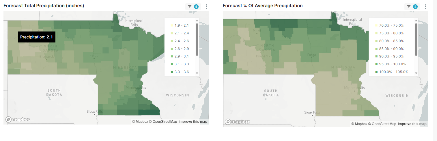
Let’s take a look at June:
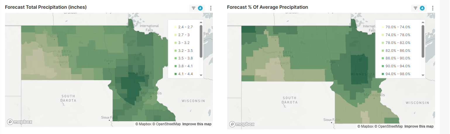
Notice the “dry pocket” west of Bismarck. This is NOT good news for the drought conditions.
Here is a look at the F/M area for June:
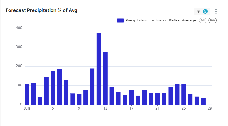
There are a few storm systems during the month of June. One right around Ribfest 4-7th then a larger storm with severe potential 11th-13th and another weaker storm around the 22nd-24th.
Here’s a peek into July:
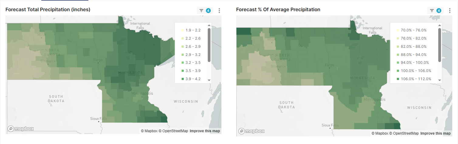
It still remains below ave in regards to rainfall in the west but not as bad as June
Here’s a look at July for the F/M area:
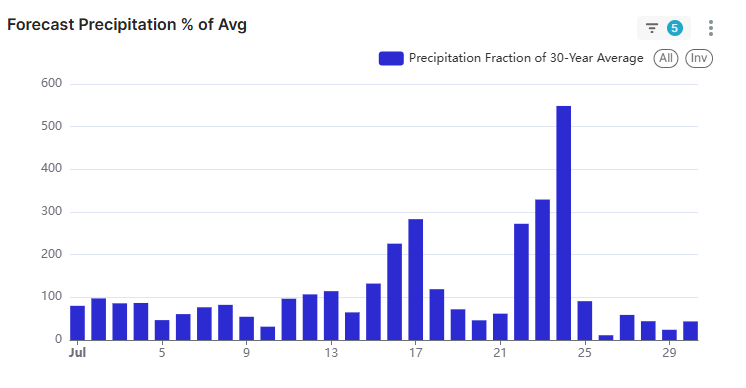
July should start out rather quiet. A weak system early July and another one around the 12th/13th. A larger storm with a severe threat moves in from 15th-17th and a WET system from the 22nd-24th.
Here’s a look at August:
A wetter look across much of the state!! This month should help some of the dry conditions out west.
Here’s a look at the F/M area for August:
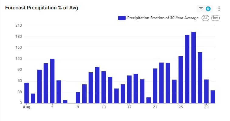
August looks like a wet start and end to the month. Storm rolling in on the 3rd-5th has severe potential. WeFest looks dry!! A few “weaker” storms 11-13th and 21-23rd with another WET system around the 25th through the 28th.
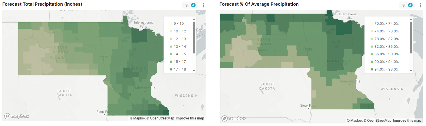
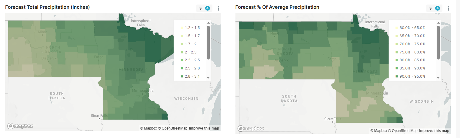
All in all for the eastern 1/3rd of ND into MN we should have ample moisture for the spring/summer with drier conditions out west. Temps across the entire area are expected to be at or above normal this spring/summer. This is a look at precip totals from May through August: