It’s a difficult forecast when parts of the area are going to feel a significant impact while others won’t really be impacted at all. Let’s break it down:
After record or near record highs today, a strong but quick moving storm will impact the area starting tonight into Saturday afternoon.
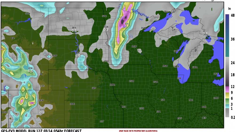
Here are a plethora of models with snow forecasts:
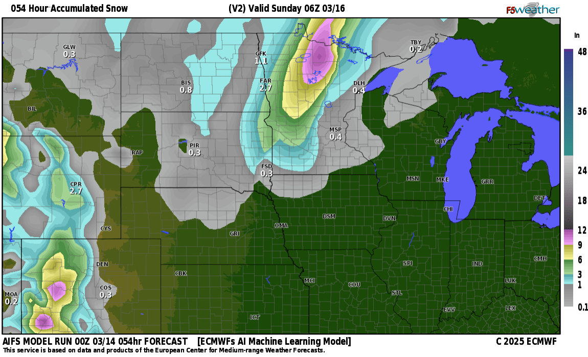
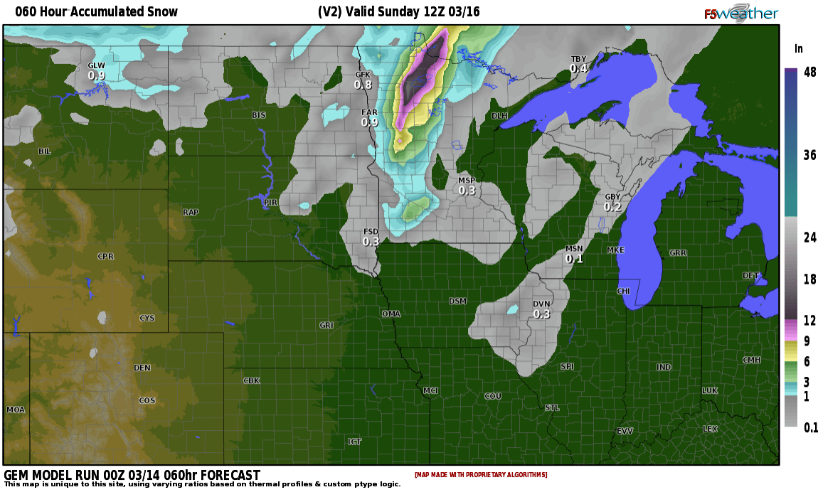
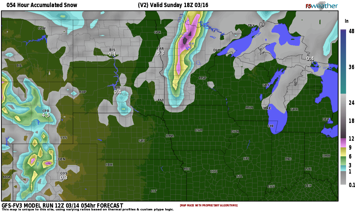
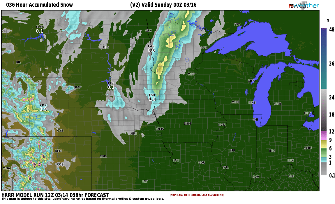
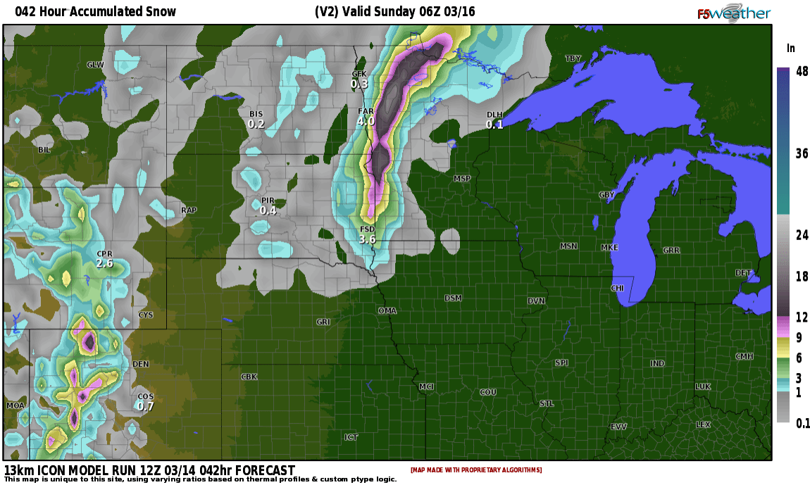
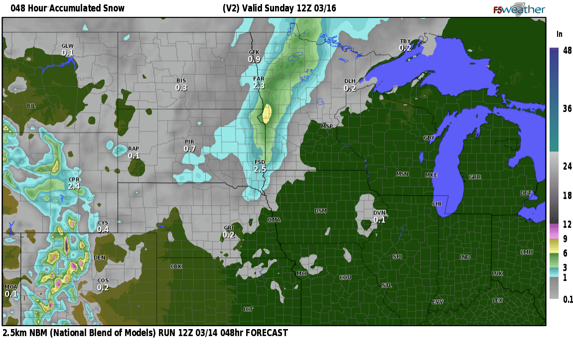
What I want to focus on is what most ALL the models trends are forecasting and that is the heaviest axis of snow is shifting farther east into Lakes country and out of the Valley. Now let’s not let our guard down just yet because we will have a period of wintry mix (sleet/frz. rain) overnight that does change to snow after 6am. Winds will STILL be a factor with this storm as winds will be gusting to or just over 50mph through the morning hours. So, even in the F/M area with around 1-2″ of snow expected, we will be impacted by blowing snow and reduced visibility. There will be banding of the snow so some areas in the Valley could get around 1″ while 10-20 miles east gets 3-5″ Numerous advisories and warnings for the Valley into Lakes country:
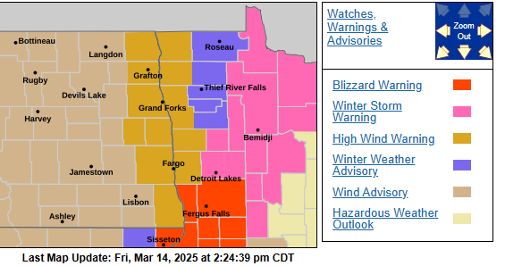
High wind warning for the valley along with a Winter weather advisory. Winter storms warnings and blizzard warnings to our east into Lakes country. Travel will be difficult in the early morning on Saturday.
Now, as you go east into Lakes country where higher snow totals will occur, it’s going to be a mess.
Travel is not recommended east of the Valley through afternoon on Saturday. Going west of the Valley, conditions should be tolerable. Have a GREAT weekend and it looks like we MAY have dodged a big one here in the F/M area.