Fires continue to burn sending wildfire haze across the United States. Monday, July 22 2024 was the first day in Fargo to see thicker surface haze to reduce visibility through the later afternoon and evening. Unfortunately, there are a few more days where surface layer haze will be affecting visibility and air quality across the region. Frankly, fires are not expected to stop anytime soon and haze is likely to funnel across the US through this week and likely the next couple of weeks. Towards the end of this week southerly winds will try to help push some of the smoke out of the area but more is likely to fill back in from fires on the West Coast of the US and the Pacific Northwest.
The Fargo Air show Is this weekend 7/27/34 and 7/28/24. Will the wildfire haze affect the show? It is still a little early to tell for sure but as surface-level winds pick up out of the south and upper-level winds switch more southwest and westerly, more of this haze should be able to blow out of the area. We will keep an eye on how US wind fires are burning through the week and give another update soon. However in my opinion I do not expect conditions to be as bad as they were on Monday or what is expected for Tuesday 7/23/24.
Here are the latest of near surface and upper level haze to push across the Northern Plains Tuesday and Wednesday 7/23/24 – 7/24/24.
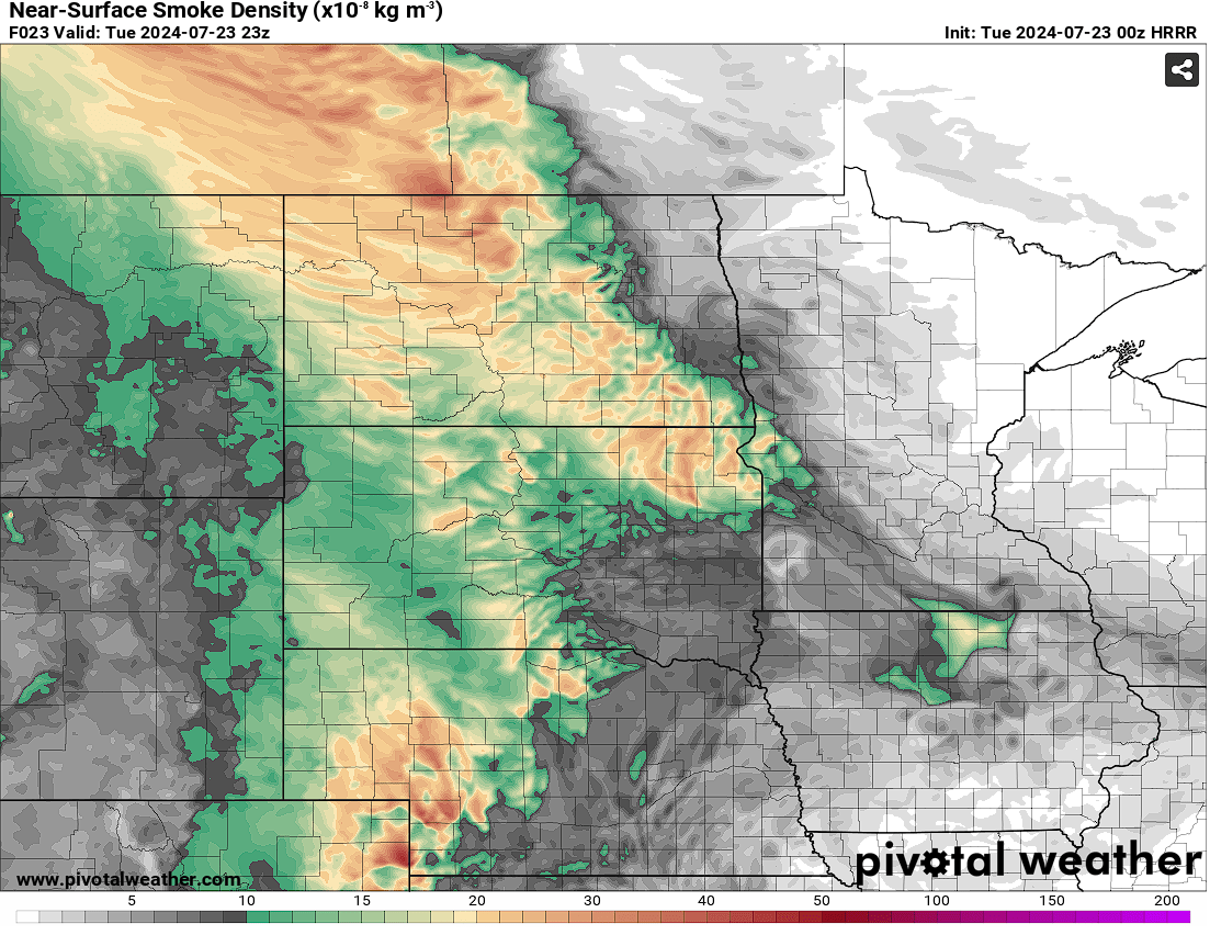
0z HRRR Near Surface Smoke forefast for 7/23/24 via pivotal weather
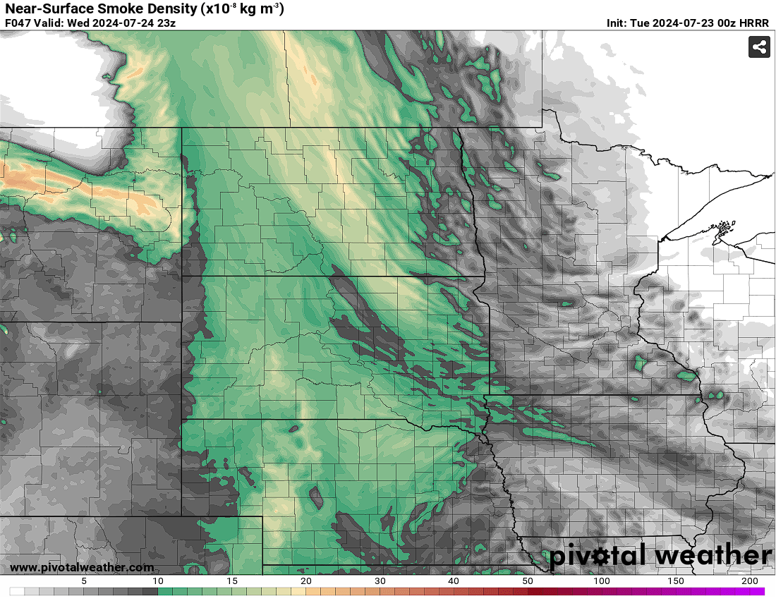
0z HRRR Near Surface Smoke forefast for 7/24/24 via pivotal weather
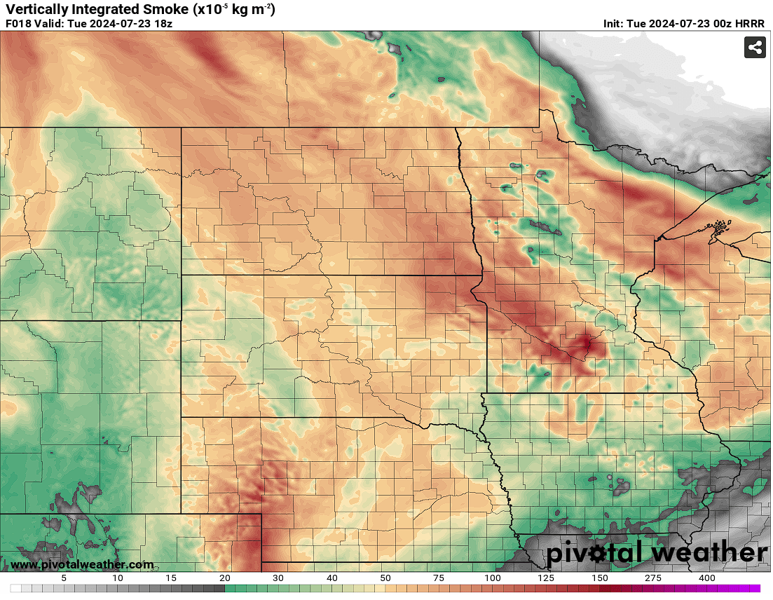
0z HRRR Upper level Smoke forefast for 7/23/24
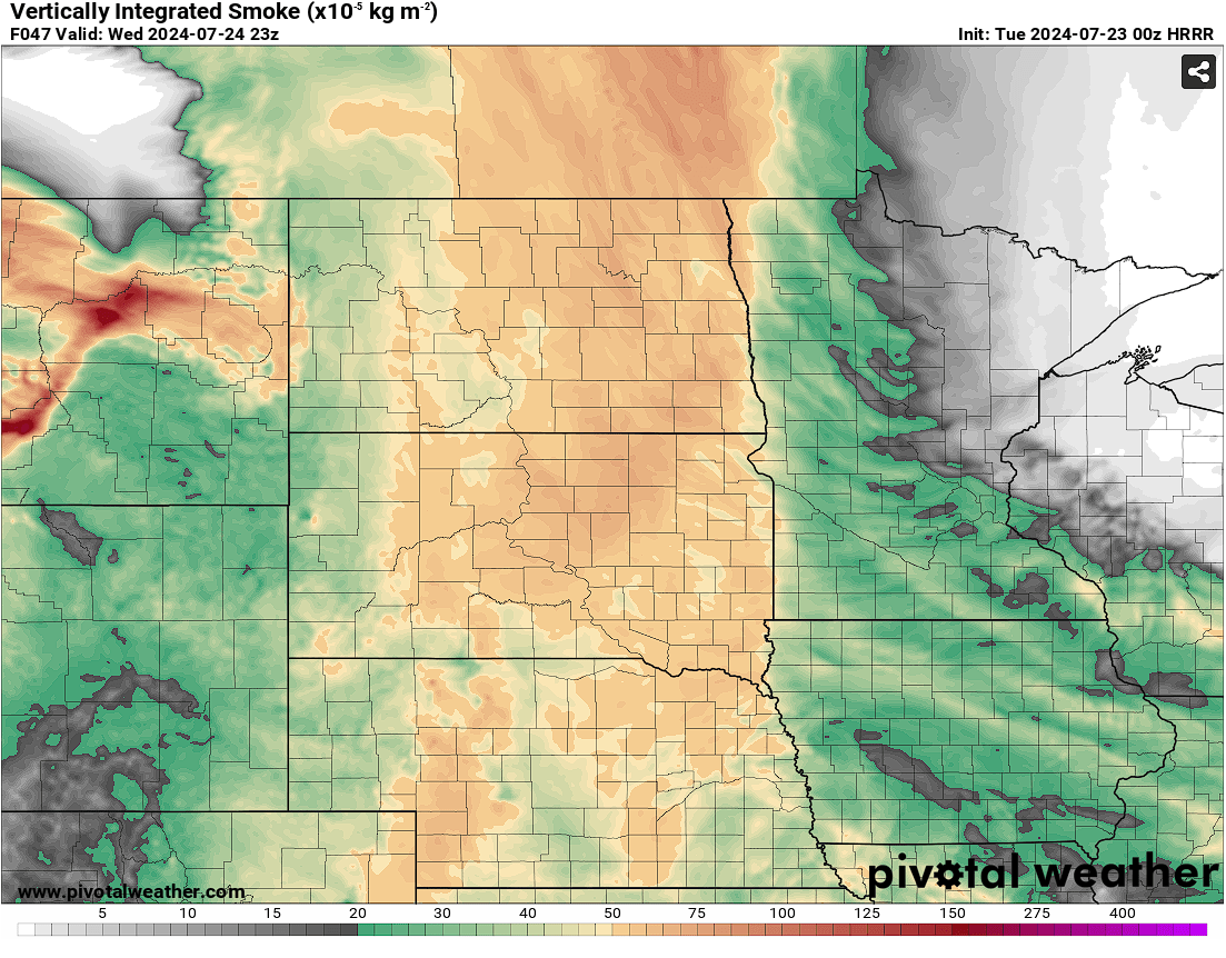
0z HRRR Upper level Smoke forefast for 7/24/24 via pivotal weather
Meteorologist,
Justin Storm