A textbook “bomb cyclone” will be pulling out of the Rockies Fri/Sat. Out ahead of this storm, near record warmth today and tomorrow, then the fun starts!! Rain and thunderstorms will enter the area Friday evening. It will feel like spring on Friday with increased humidity. That rain will change to snow across the Valley Friday night and Saturday looks to be a MESS around the Valley and points eastward.
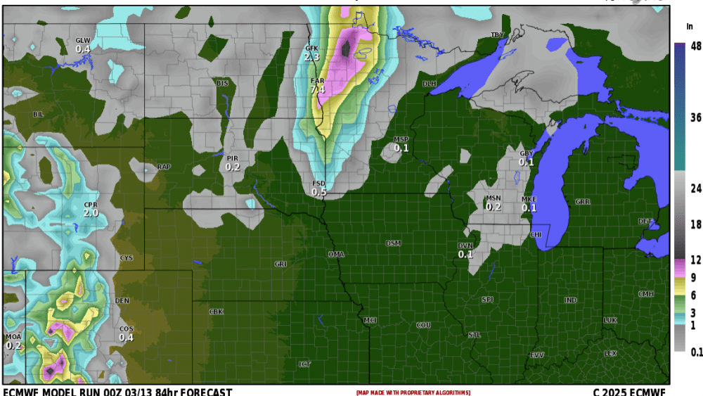
Here’s a look at a few of our models projected snowfall totals:
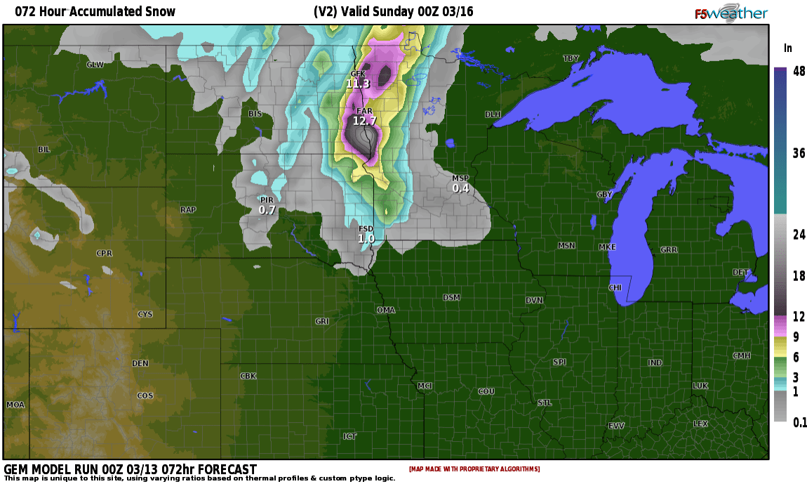
Courtesy F5 weather
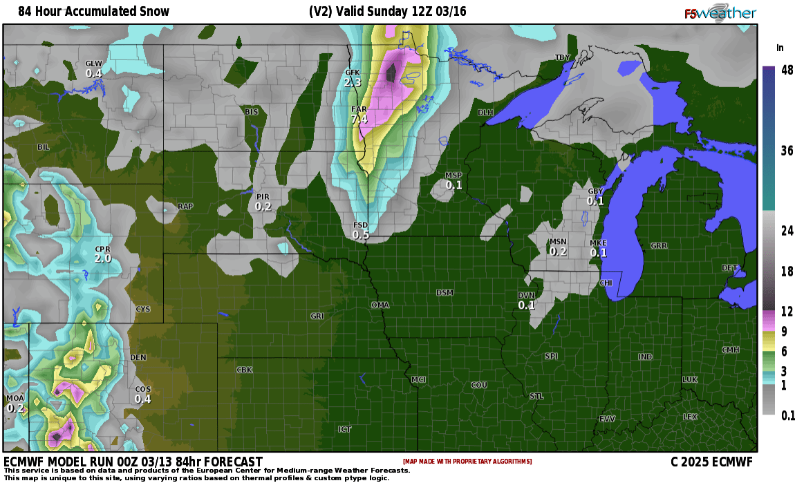
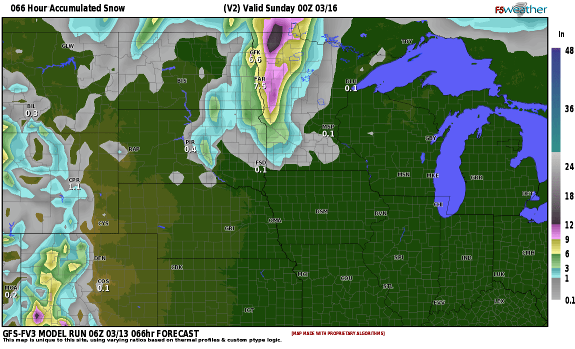
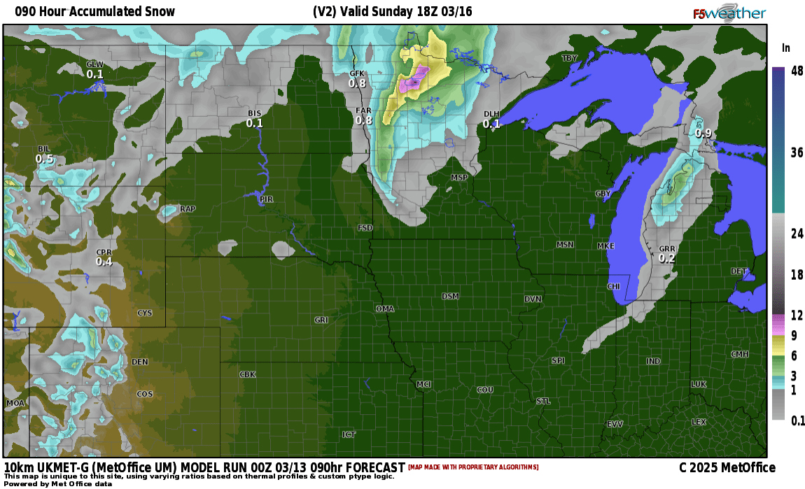
Most of the models are predicting a blizzard from Fargo/eastward. One thing for sure, if you have travel plans on Saturday, make plans to change those. I will be updating snowfall totals on Friday morning. Currently, my thinking is around 4-6″ in the F/M area with higher amounts just east into Lakes country. Stay tuned……