It is another weekend of back to back to back chances for storms of which some could be on the strong to severe side. Like past weekends there will be a lot of dry hours and some locations won’t see showers or storms. Most chances will come through the evenings and overnight with an exception for Sunday which may start earlier in the afternoon and move into Sunday night.
Friday evening and overnight is the first chance for strong to severe storms and it favors areas north of Fargo through the Central and Northern Valley as well as Northwestern Minnesota. The main threat with these storms will be wind gusts of 60 mph and one inch hail, although an isolated tornado will be possible. A marginal or level 1 of 5 risk for severe weather has been issued for portions of Eastern North Dakota and Northwest Minnesota.
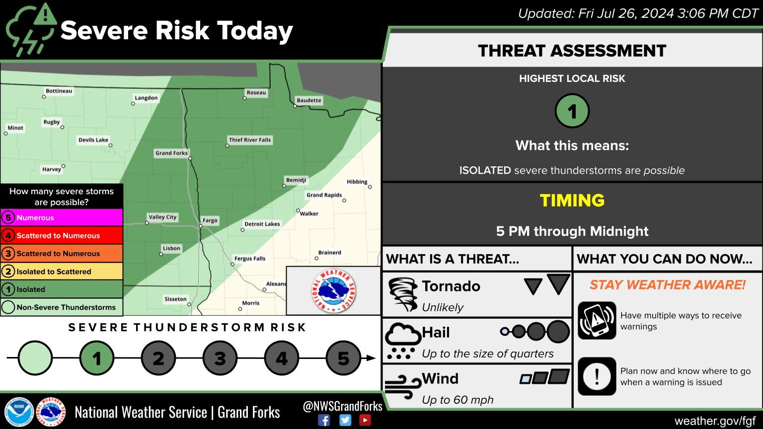
7/26/24 severe weather risk via National Weather Service Grand Forks, ND.
The second threat window develops Saturday evening and Saturday night. The main threat will again be damaging wind gusts and one inch hail or larger, an isolated tornado although unlikely can’t be ruled out. A slight or level 2 or 5 risk for severe weather has been issued for portions of North Dakota and Minnesota as well as a marginal risk.
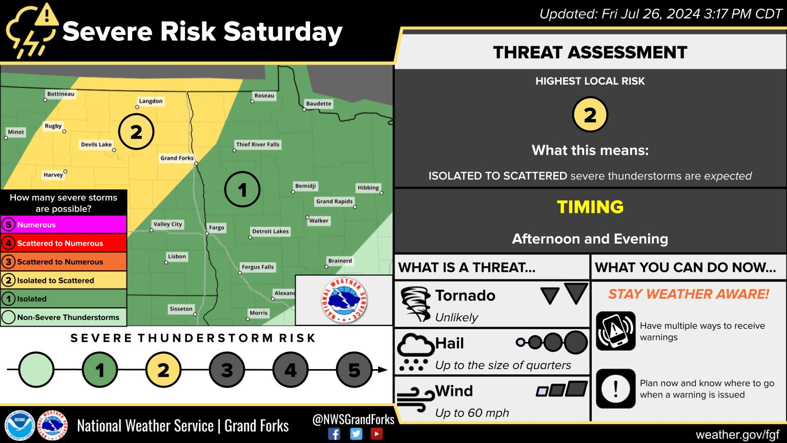
7/27/24 Severe weather risk issued 7/26/24 via National Weather Service Grand Forks, ND.
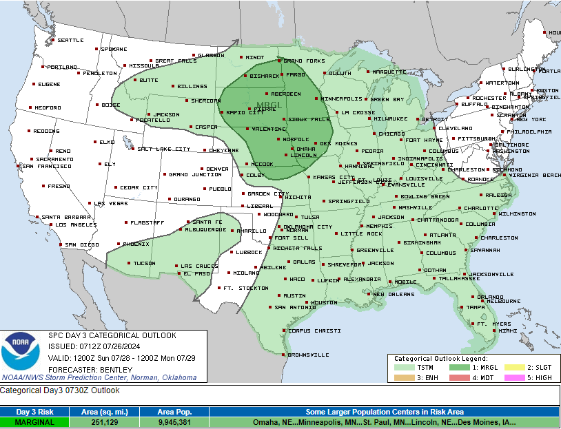
Sunday afternoon and Sunday night is the third chance for showers and storms that could be strong to severe with the main threat again hail and wind. A day three marginal risk has been issued for the area.
You can always get the latest Storm Risk Outlooks Here from the Storm Prediction Center or the National Weather Service of Grand Forks.
Meteorologist,
Justin Storm