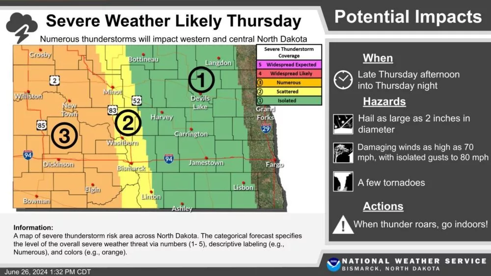
As another disturbance tracks through the Northern Plains another round of storms is expected to develop late Thursday into Thursday night. Storms are expected to initiate in Eastern Montana and Western North Dakota. Storms will initially be cellular or singular and have the potential for a few isolated tornadoes, large hail, and damaging wind gusts. Moving more into the evening and overnight hours, storms will become more likely to form clusters and line out. As the storms track into Central and Eastern North Dakota, they will start to weaken. The overnight threat is expected to turn more into a wind threat and less for large hail and tornadoes. Storms will exit into Minnesota Friday morning but there may still be a strong storm.
Another chance of storms will come later in the day on Friday for the Red River Valley and areas of Minnesota. This potential round of storms looks a little conditional right now and looks a little iffy from this standpoint. However, there is potential for strong storms to develop. See the day three outlook for ND and MN below issued at 3:08 AM 6/26/24.
You can always see the latest outlooks here!
Meteorologist,
Justin Storm