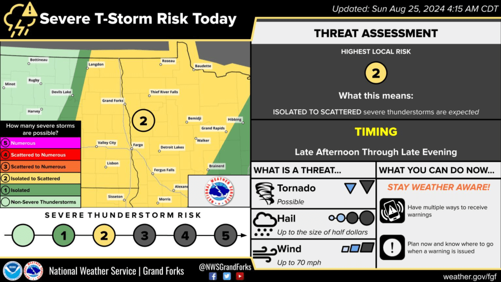
A Slight risk or level 2 of 5 has been issued for the potential of isolated to scattered severe storms through this evening and into the overnight hours. As a cold front drops out of Canada into the Dakotas and Minnesota, storms may develop along this front late this afternoon and tonight, mainly between 7:00 pm and 4:00 am Monday. A cap still looks to be in place that may prevent some storms from forming. Although still possible in the area shaded in yellow, storms look to favor areas of northwest Minnesota currently tonight. Some of these storms could be on the severe side with a tornado and large possible late this afternoon and evening then turning more into a wind and or hail threat through the overnight hours.
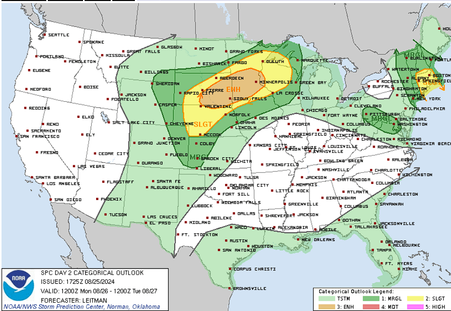
Another round of storms is expected and more likely Monday afternoon and evening favoring areas south of I94 and Minnesota that could be on the severe side with a couple of tornadoes, damaging wind gusts, and large hail all possibilities.

Severe Weather Outlook Day 2 for Monday 8/26/24 via Storm Prediction Center
Meteorologist,
Justin Storm


