There is a level 1 out of 5 risk for severe thunderstorms in Eastern ND and portions of Northwestern MN Friday night. Storms will form out west late this afternoon and evening then move east and southeast across the region through the overnight and early morning hours. If severe thunderstorms do develop the main threats are hail sized up to quarters and wind gusts up to 70 mph.
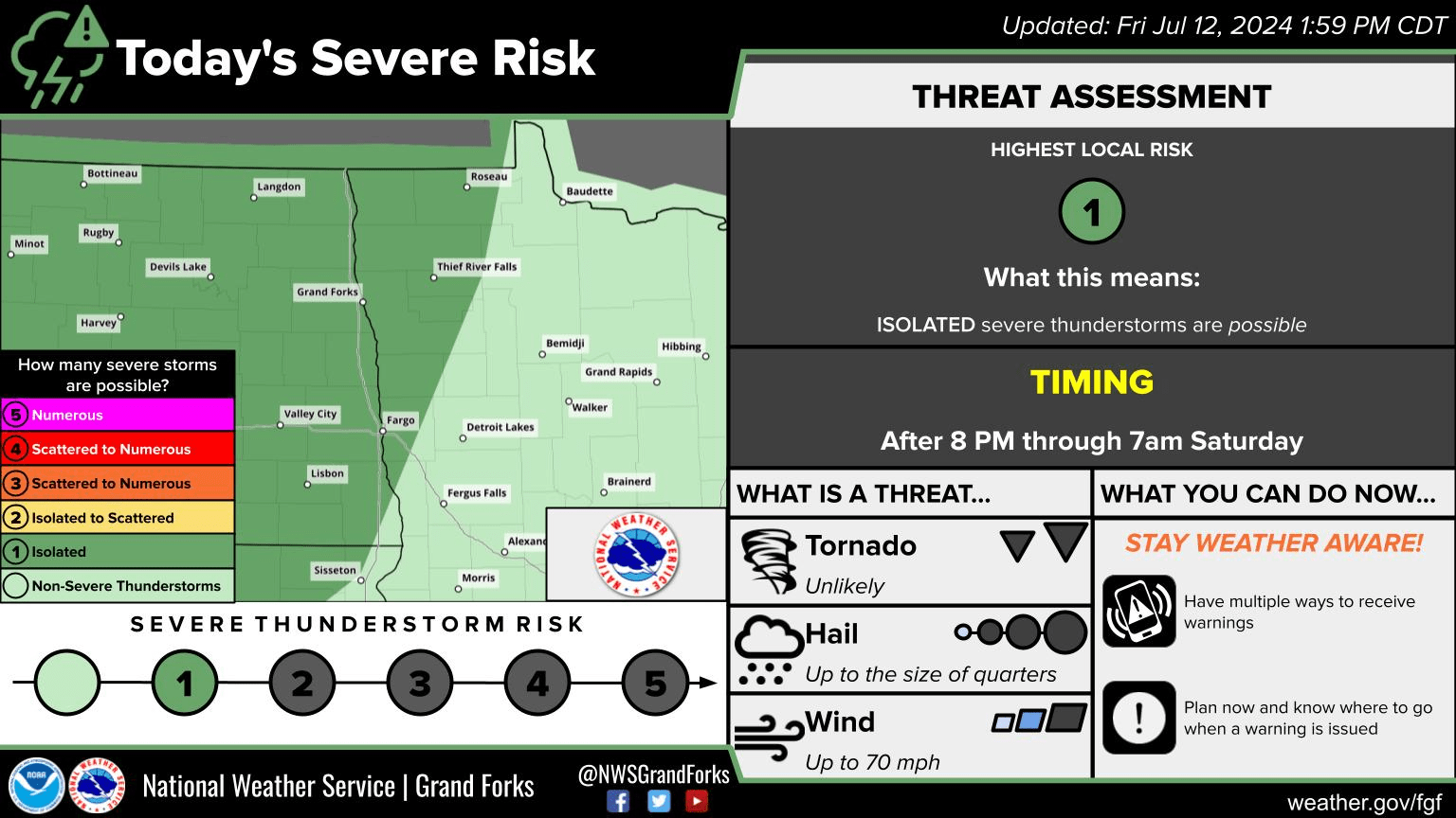
NWS Grand Forks ND, Severe Weather Outlook from SPC Via NWS KGFK Facebook page.
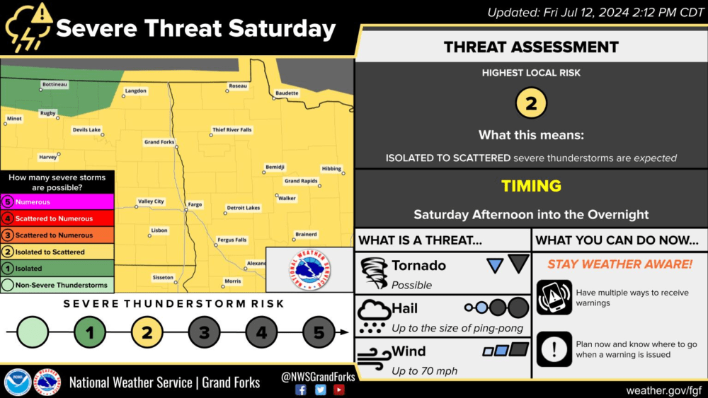
There is a level 2 out of 5 (slight risk) for severe thunderstorms on Saturday afternoon and evening. During the afternoon and early evening, the threats will be hail to the size of ping pong balls, 70+ mph winds, and the potential for a few tornadoes, favoring MN. By late evening and overnight, the threat will mainly be winds to 70 mph and a couple of tornadoes possible.
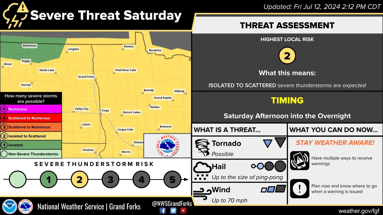
NWS Grand Forks ND, Severe Weather Outlook from SPC Via NWS KGFK Facebook page.
There is also a level 2 out of 5 (slight risk) for severe thunderstorms Sunday night into early Monday Morning with the main threat being damaging winds and hail.
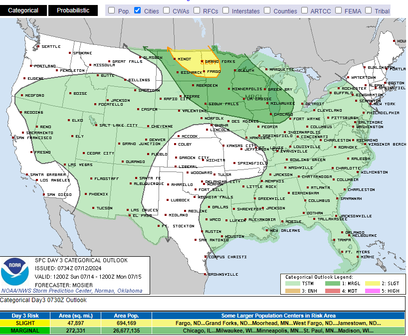
Storm Prediction Center’s, Day Three Severe Weather Outlook for Sunday 7/14/24 via SPC
Meteorologist,
Justin Storm