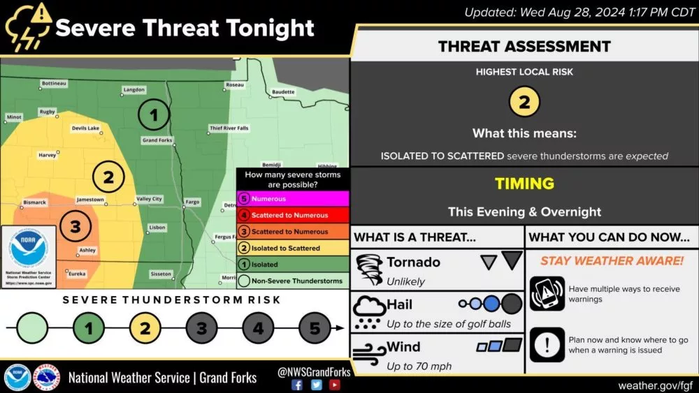
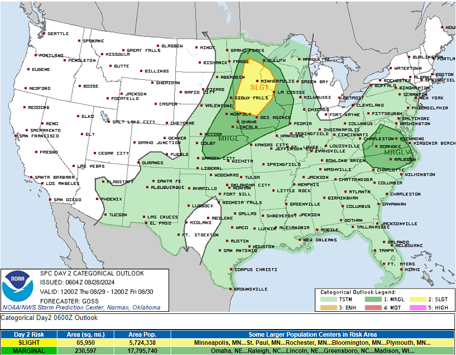
Another marginal risk for severe weather has been issued by the Storm Prediction Center for the Red River Valley for isolated severe storm potential tonight. A slight risk and enhanced risk (level 2 and 3 out of 5 respectively) for scattered to numerous severe storms have been issued for areas west of the valley through this afternoon into Wednesday tonight. This severe threat shifts east into Minnesota on Thursday.
Thunderstorms are expected to form in West Central North Dakota this late afternoon and evening, mainly after 4:00/5:00 pm. Storms out there this evening will likely be severe and will hold the potential for a couple of tornadoes, large hail, and damaging wind gusts.
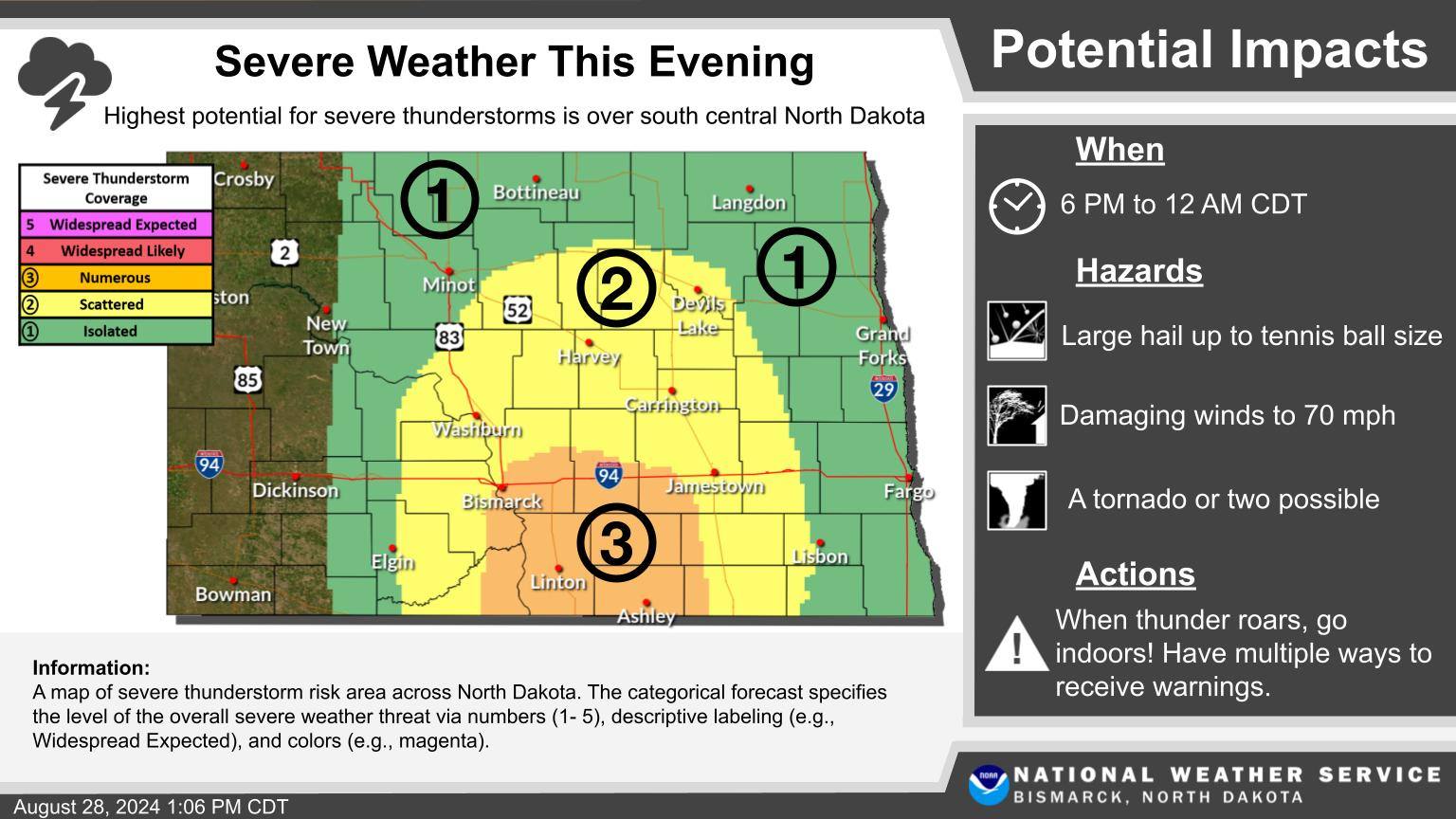
Severe Weather Risk for 8/28/24 via National Weather Service Bismarck, ND.
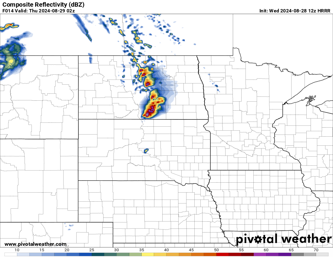
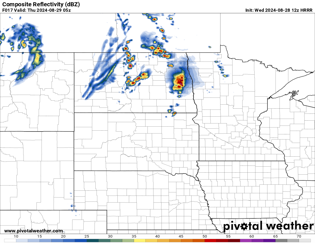
Storms will track through Central North Dakota towards the Devils Lake Basin and Northern Valley of the Red River then Northwestern Minnesota through the overnight hours. Storms will be in a “weakening” phase overnight and turn more into clusters. Becoming more of a heavier rain and wind threat but remains possible to be severe with large hail and damaging wind gusts upwards of 70 mph possible. Although still possible the tornado threat will lessen through the overnight.
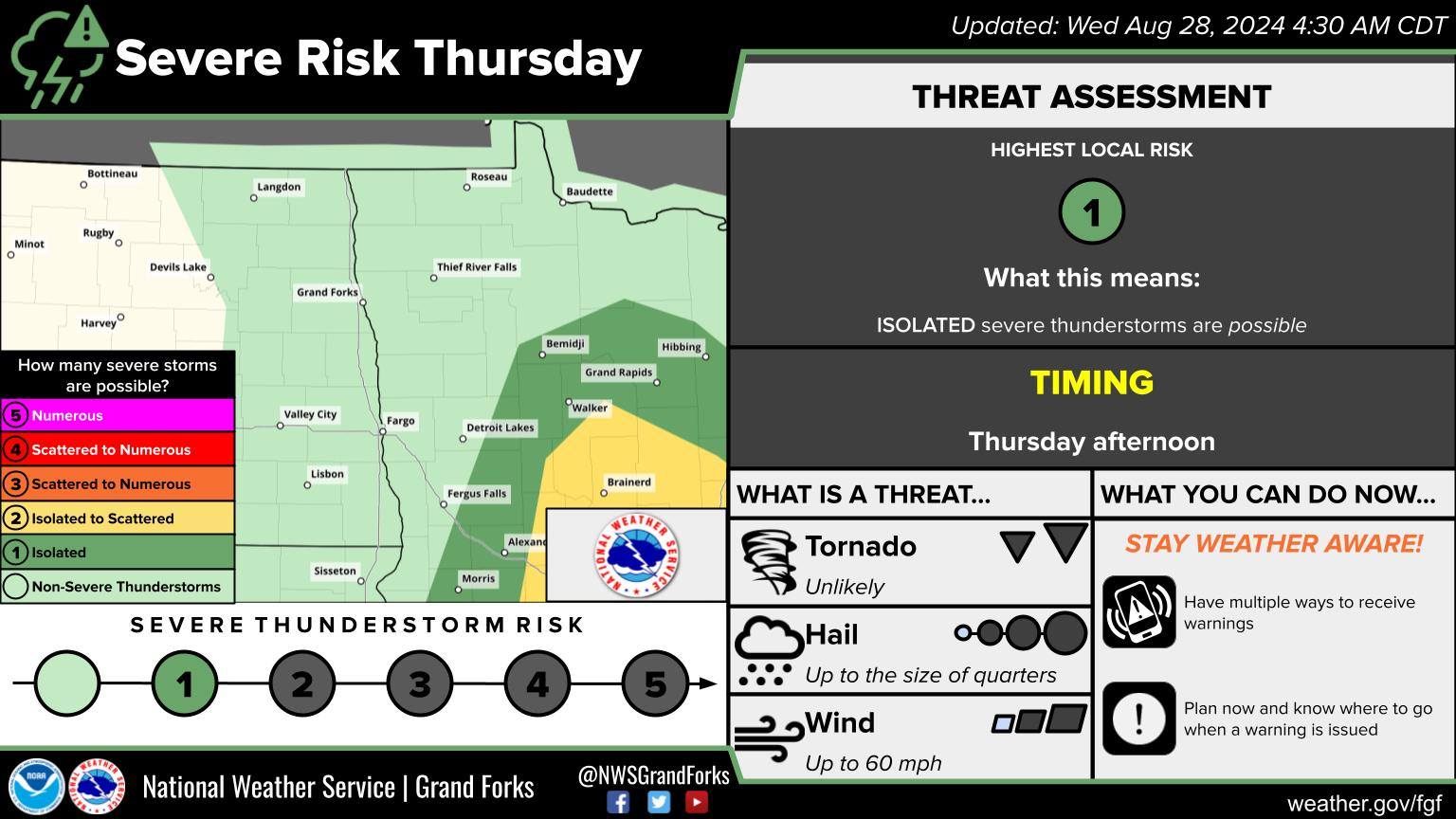
Severe Weather Risk 8/28/24 via National Weather Service Grand Forks, ND.
Although possible to see a couple of storms around Fargo ND, or within the Souther Valley and portions of Lakes Country, MN. Most storm activity looks to remain to the west and north.
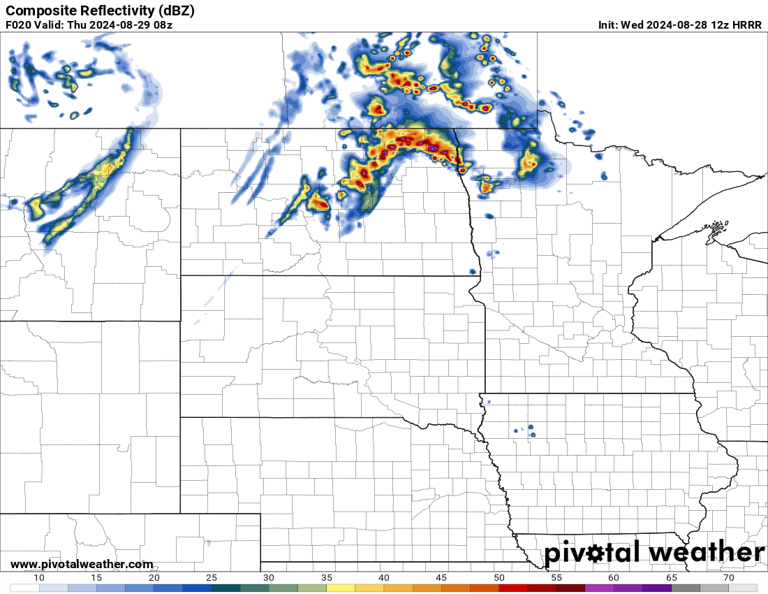
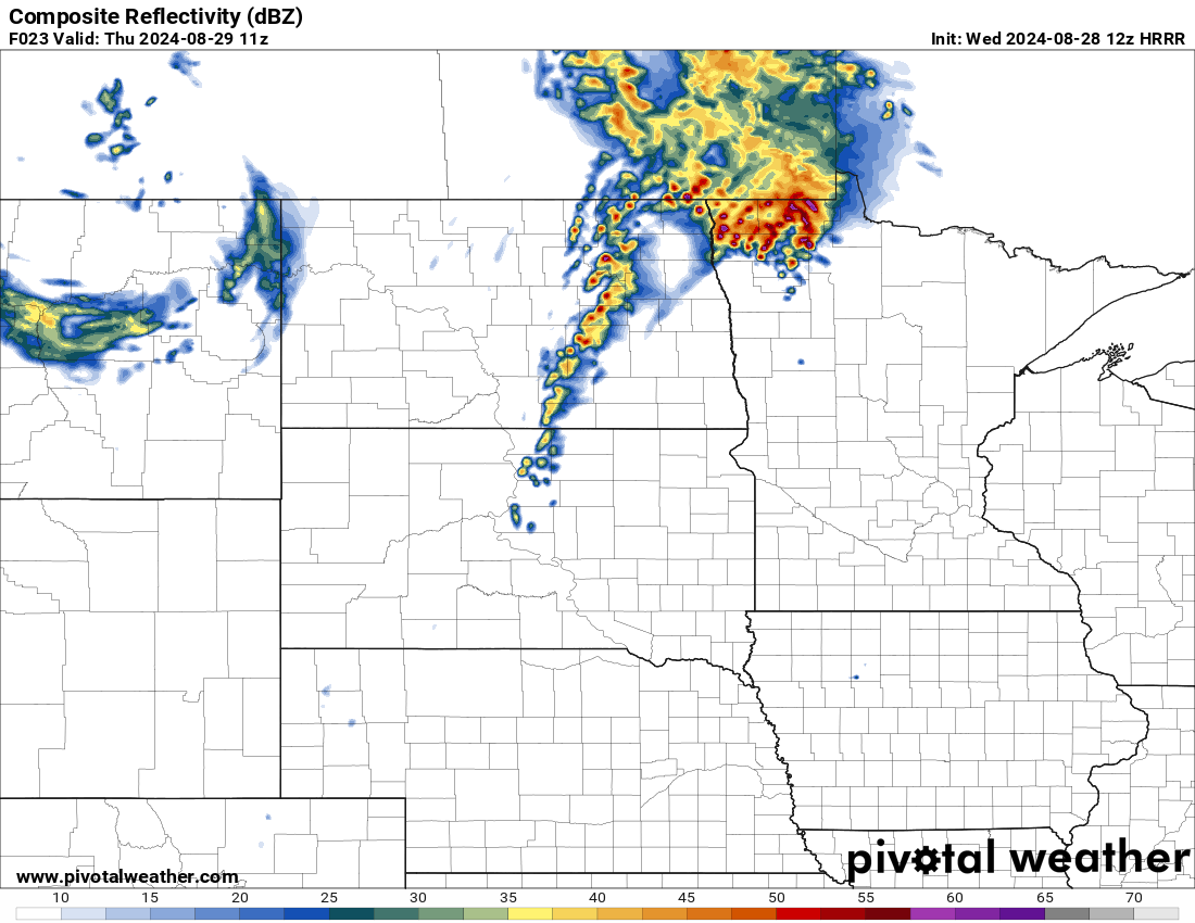
Expected another line of scattered showers and storms to push into the valley through late Thursday morning to early afternoon along a cold front. These storms should not be strong to severe until they head into central Minnesota through the afternoon. Storms through Thursday afternoon in Minnesota will pose the risk of a couple of tornadoes, damaging winds, and hail as a larger and longer line of storms forms along the cold front. (Check out the timing and simulated radar further down)
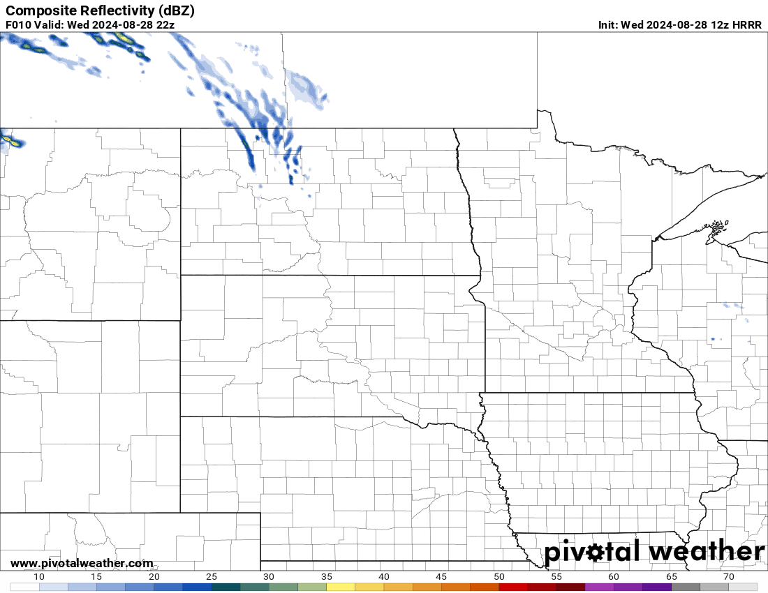
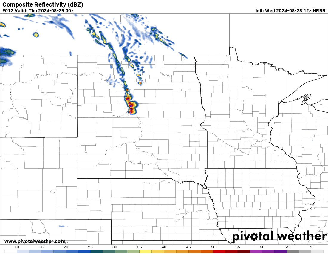
Here is the latest model guidance on timing and location of storms through 5:00 pm Wednesday, 7:00 pm, 9:00 pm, 12:00 am, 3:00 am, 6:00 am, 9:00 am, 12:00 pm, 3:00 pm, and 6:00 pm Thursday, central time.
12z HRRR Simulated Reflectivity (Radar) 5:00 pm via Pivotal Weather
12z HRRR Simulated Reflectivity (Radar) 7:00 pm wed via Pivotal Weather
12z HRRR Simulated Reflectivity (Radar) 9:00 pm wed via Pivotal Weather
12z HRRR Simulated Reflectivity (Radar) 12:00 am thurs via Pivotal Weather
12z HRRR Simulated Reflectivity (Radar) 3:00 am thurs via Pivotal Weather
12z HRRR Simulated Reflectivity (Radar) 6:00 am thurs via Pivotal Weather
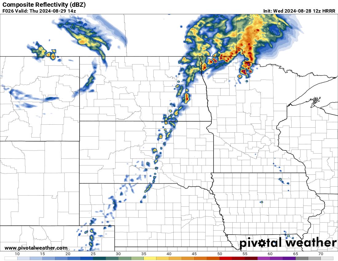
12z HRRR Simulated Reflectivity (Radar) 9:00 am thurs via Pivotal Weather
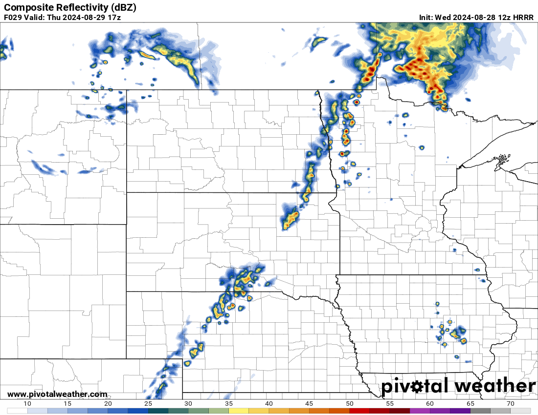
12z HRRR Simulated Reflectivity (Radar) 12:00 pm thurs via Pivotal Weather
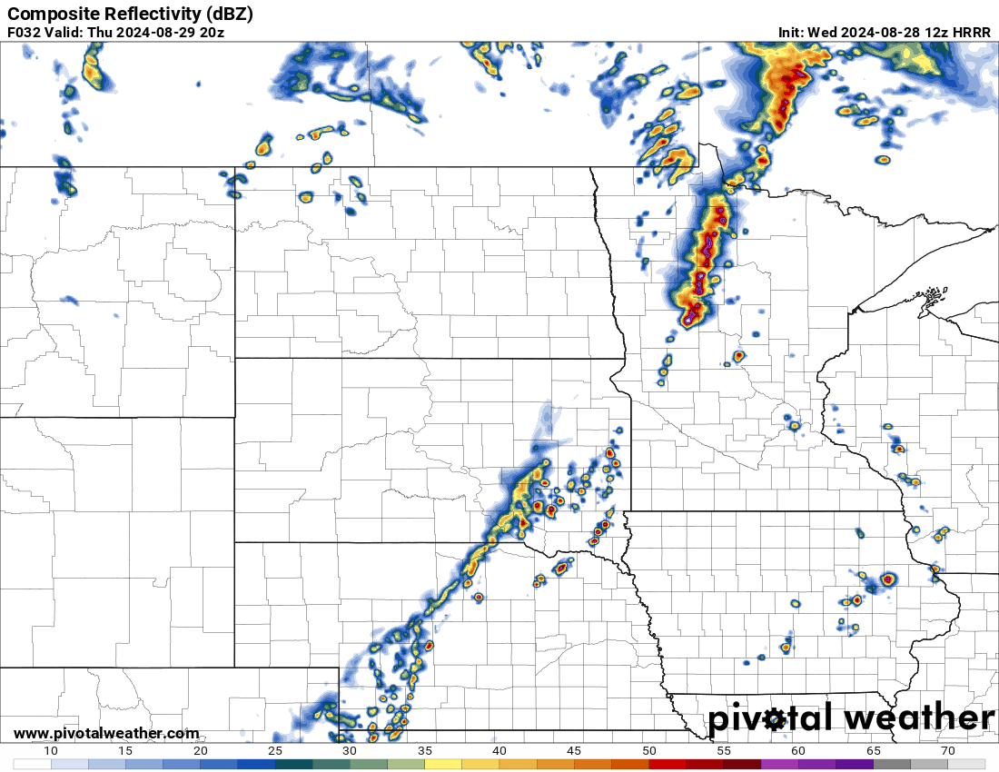
12z HRRR Simulated Reflectivity (Radar) 3:00 pm thurs via Pivotal Weather
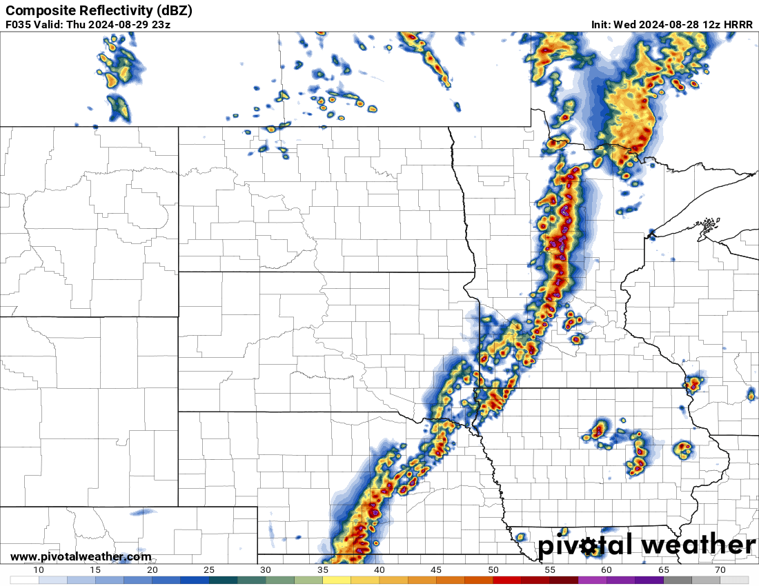
12z HRRR Simulated Reflectivity (Radar) 6:00 pm thurs via Pivotal Weather
Meteorologist,
Justin Storm