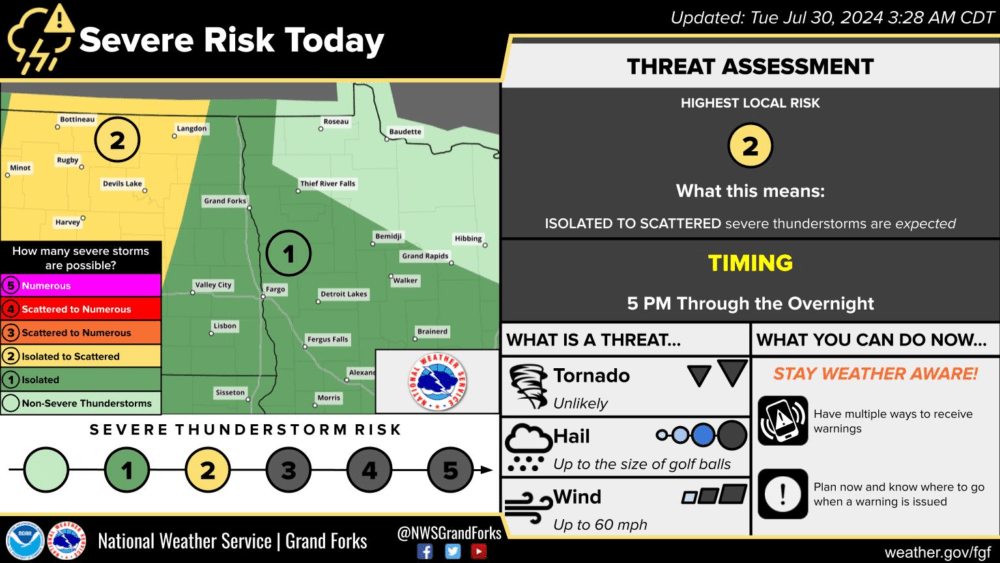
Another round of potential storms will occur from Tuesday evening into Wednesday. A slight risk (level 2 of 5) and marginal risk (level 1 of 5) for severe weather have been issued for portions of North Dakota, Minnesota, and South Dakota. Although storms do not look overly likely through Eastern North Dakota or Minnesota this evening or tonight, it will be possible for a few storms to develop. If storms can develop they would do so in an environment that would support strong to severe storms with the main concern being hail and wind. In areas of North and Central North Dakota (within the yellow slight risk area), a couple of storms will be a little more likely this evening. Those storms would hold a potential for an isolated tornado, hail, and strong wind gusts.
SPC Severe Weather Risk for 7/30/24 via National Weather Service Grand Forks ND.
Now storms will become more likely as we head into the morning hours of Wednesday, more in areas of South Dakota and Minnesota (within the yellow-shaded slight risk area) but again still possible in portions of Eastern North Dakota. Through the rest of the day, a few popup strong storms will also be possible in areas of Eastern North Dakota and Minnesota on Wednesday. Here is the Day two outlook for Wednesday.
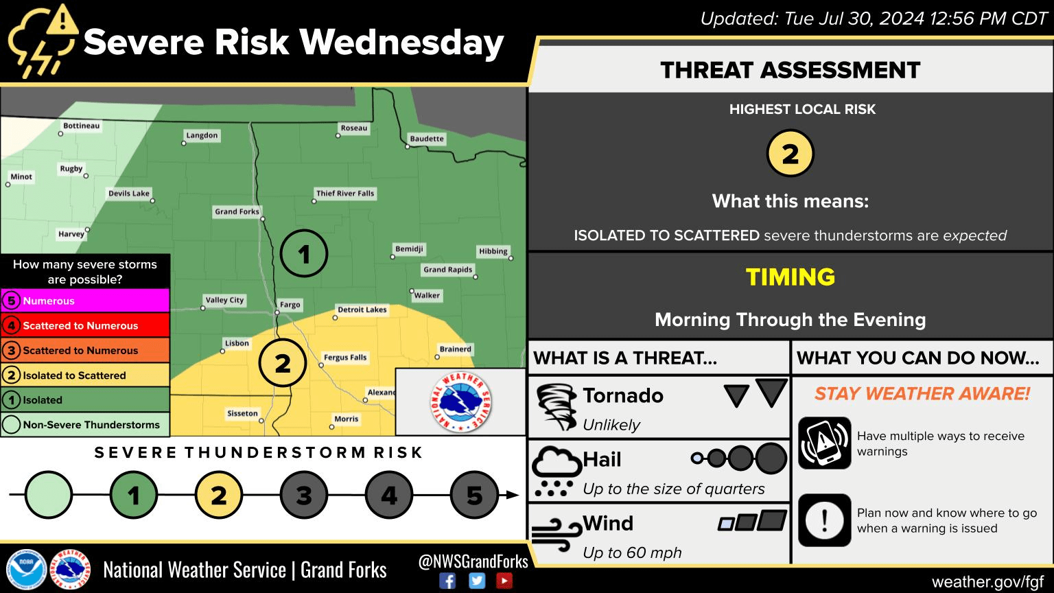
Day two SPC Severe Weather Risk for 7/31/24 via National Weather Service Grand Forks ND.
Meteorologist,
Justin Storm