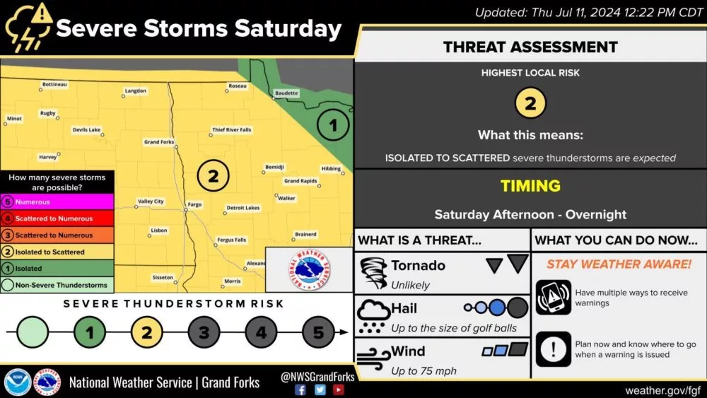
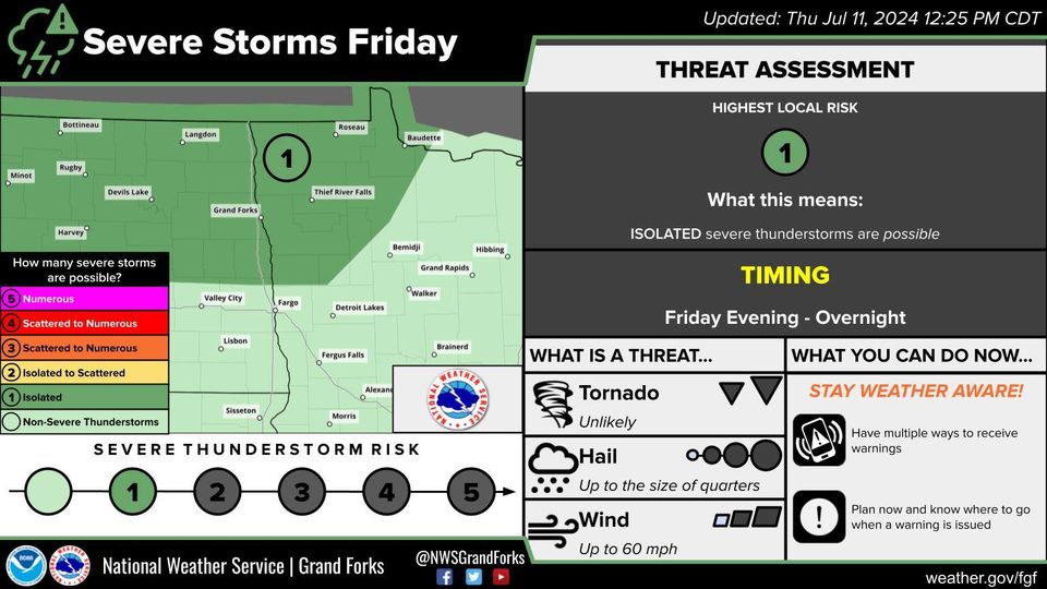
Thunderstorm chances return to the area late Friday through the weekend into next week. As heat and humidity levels rise, so does the amount of energy available for storms. A marginal risk (level 1 out of 5) for isolated strong storms Friday into Friday night has been issued for areas of North Dakota into the Northern Valley of the Red River. A slight risk (level 2 out of 5) for severe thunderstorms on Saturday late afternoon/evening and overnight has also been issued across the area. The main severe threats with the storms will be wind Friday night in the northern valley then large hail and damaging winds Saturday. Even though the main threat window is for Saturday night, I see the potential for a couple of storms to develop late Saturday afternoon and evening. There is also potential on Sunday into Sunday night for some strong storms but favoring more southeast of Fargo into areas of Minnesota.
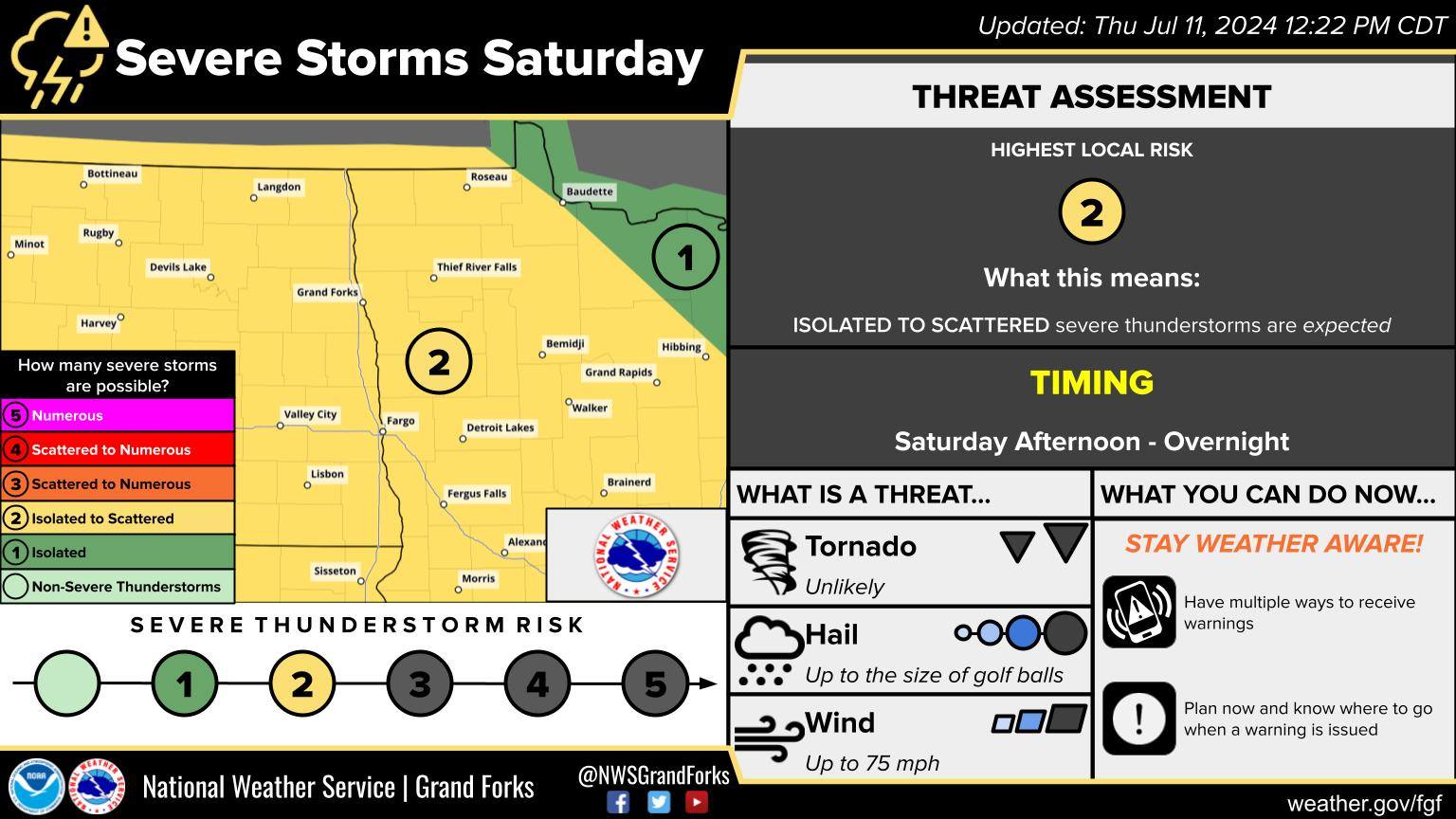
NWS Grand Forks Severe weather outlook for Saturday 7/13/24 via Facebook NWS Grand Forks ND page
Meteorologist,
Justin Storm