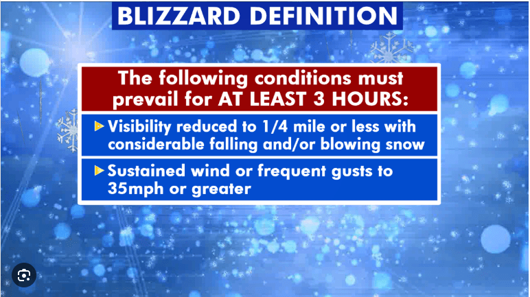
The dreaded “B” word keeps getting tossed around……BLIZZARD!!! Ok, now that I have your attention, what constitutes a blizzard?
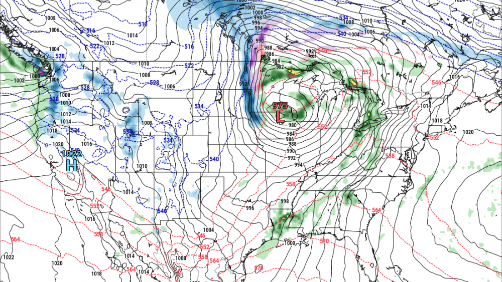
Lets take a look at the upcoming storm for Fri/Sat.
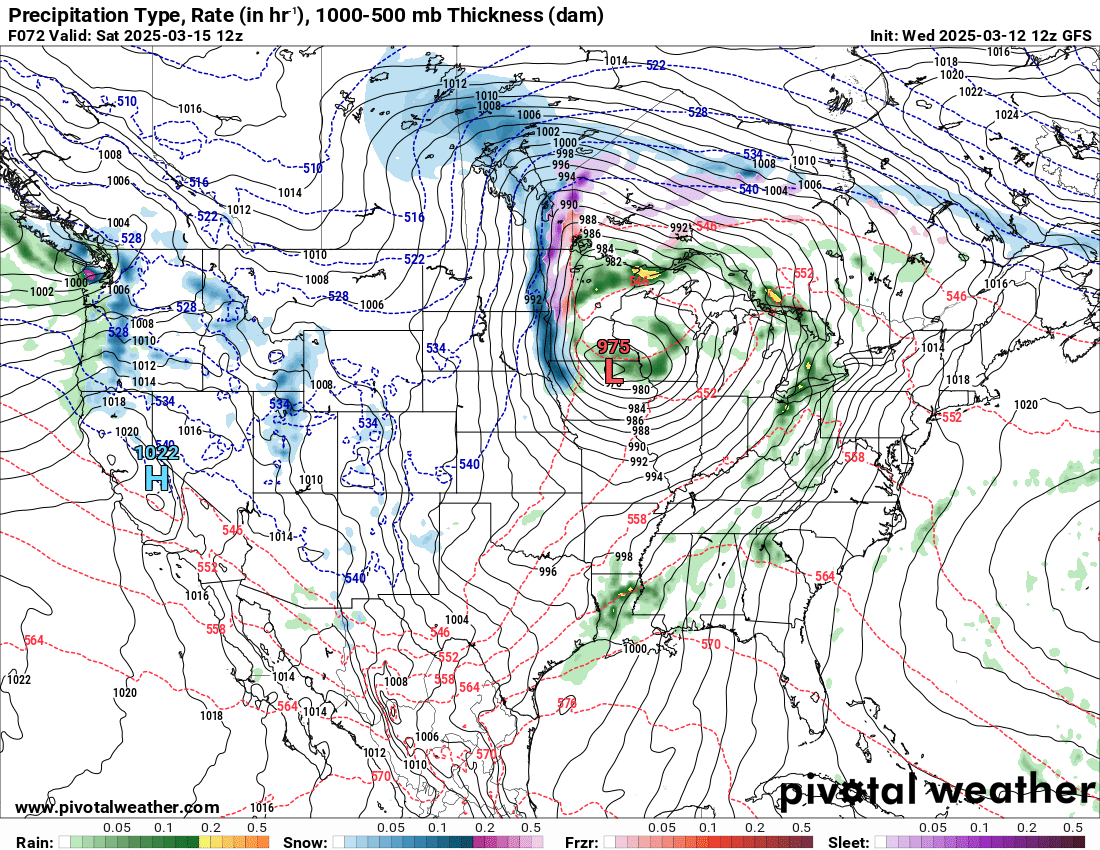
Courtesy: Pivotal weather
This is a “snapshot” of what our American model (GFS) is predicting for Saturday morning A band of snow will be aligning itself right through the Valley with very little effect to our west, outside of strong winds. Now, the storm is currently entering the west coast so as it comes ashore we will receive better model data to indicate how much snow and where the heaviest will fall. What I can tell you now is this will NOT be a huge snow maker…..BUT…..even if we get a few inches, with the wind howling out of the north, travel will be difficult on Saturday from the Valley eastward into MN. Here’s a preliminary look at snowfall expectations from a few of our models:
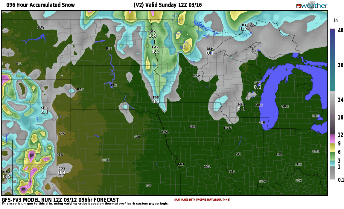
Courtesy f5 weather
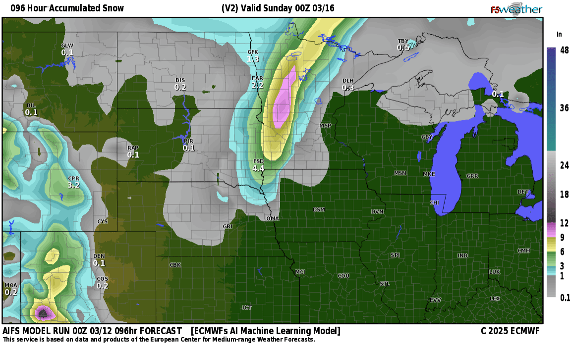
Snowfall amounts look to be around 1-4″ across the area, so snowfall amounts won’t be that high but the winds with this storm will be roaring out of the NNW at 30-50mph so what snow we do accumulate will be blowing around with reduced visibility on Saturday. There is about a 30-40% chance this storm shifts a bit farther to the east which would carry the majority of the snow out of the valley and into MN. Stay tuned…….