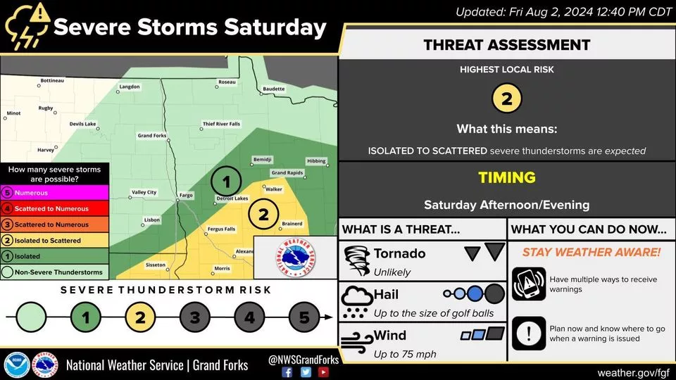
A slight risk (level 2 in yellow) and a marginal risk (level 1 of 5 in green) have been issued for portions of the area for scattered to isolated severe storm potential. As a disturbance lofts into the area, it will bring a chance for some storms to develop along a boundary through the afternoon and push south and southeast through the evening. All ingredients are looking to set up in place for storms to become strong and severe with golf ball-sized hail, damaging wind gusts upwards of 75 mph, and even an isolated tornado possible early. I mentioned in a previous article that a cap looks to be set in place that may prevent some storms from forming. This cap looks ‘weaker’ today than yesterday, or at least a greater potential of storms being able to fire through it. I know many folks will be out in Lakes Country or We Fest. Keep in mind there is a chance for strong storms and have a shelter plan in place/mind in case storms are moving into your area.
Meteorologist,
Justin Storm